NJ nor’easter #3: No big snow, some wind and surge
Let's Recap
When last we spoke, in Friday's weather blog post, I offered three track scenarios for our next potential coastal storm:
1.) Total Miss
2.) Glancing Blow
3.) Worst-Case
Models finally came around to a happy consensus Friday night. And they have since continued to suggest some variant of solution #2: a glancing blow, with limited impacts for the Garden State.
The Bottom Line
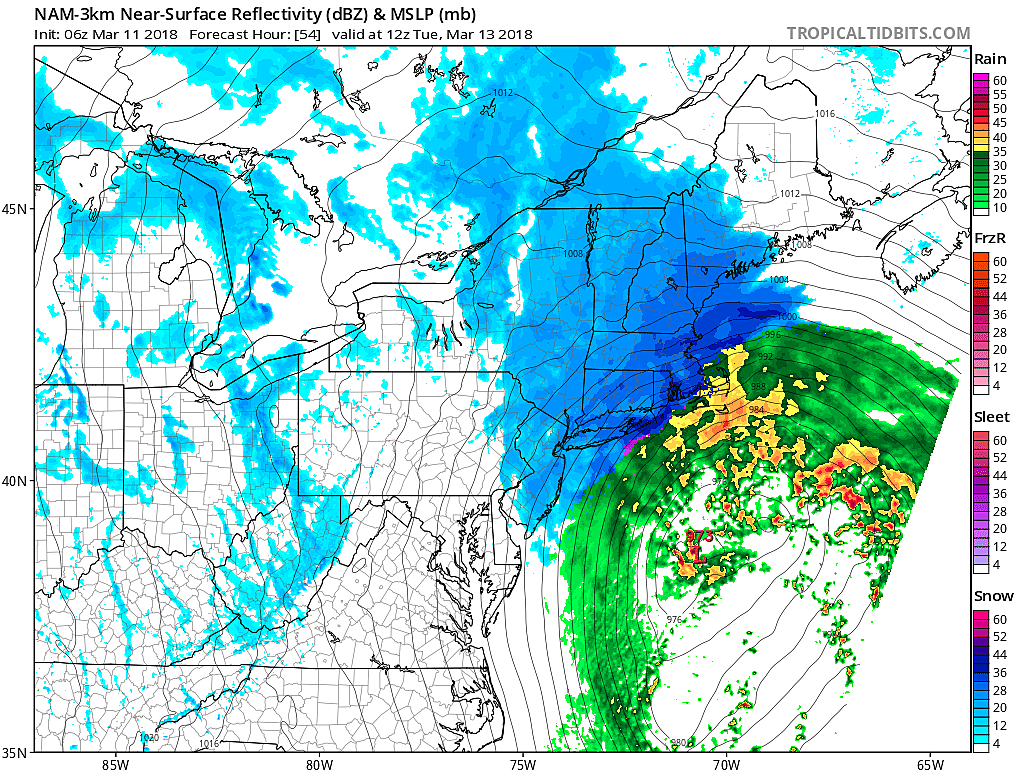
New Jersey's third coastal storm (i.e. nor'easter) this month initially raised some eyebrows due to the "worst-case" potential for another half-foot-plus of snow. While still not impossible, I believe it is unlikely that such a wintry scene would envelop the state yet again. However, sloppy travel conditions, gusty winds, and another round of minor coastal flooding are possible (if not likely).
By the way, this matches well with the "best guess" deterministic forecast I published on Friday: Periods of light snow and rain... Minor snow accumulations, on the order of an inch or two... 40 mph wind gusts and minor coastal flooding... Minor impacts, nuisance snow, no big deal.
Timeline
One notable adjustment to previous forecasts is that the storm has slowed down. Therefore, the timeline of impacts on New Jersey is now substantially later than previously reported.
Sunday and Sunday night look tranquil, and even Monday morning should be rain/snow-free. Initial raindrops and snowflakes arrive Monday afternoon (2 p.m.), spreading throughout the Garden State by Monday evening (7 p.m.).
A changeover to mostly/all snow is expected around late evening Monday (10 p.m.), likely to be the peak of the storm. Snow substantially tapers off by mid-morning Tuesday (9 a.m.), with lingering snow showers possible through Tuesday afternoon (4 p.m.).
Impacts
--SNOW: While precipitation will likely begin as a mix of rain and snow, most of New Jersey should quickly change over to snow as temperatures drop after sunset Monday. My math shows snow accumulations ranging from a coating in SW NJ to about 3 inches in NE NJ. Most of the state is looking at just an inch or two. (Note: Zero or near-zero accumulation is a distinct possibility — exact totals will depend largely on the storm's exact wiggle.) That's it. Hardly enough to shovel, and generally below "advisory" criteria.
--WIND: A bit more significant. Sustained winds of 15 to 25 mph, with gusts to 35 to 40 mph. (Direction will shift from northeasterly late Monday to northwesterly by early Tuesday.) Usually, such wind speeds would qualify as "a typical windy day," and hardly warrant extra attention. However, you are many trees and power lines across the Garden State that are still weakened from the last two storms. We really don't need another round of 40+ mph gusts right now.
--SURGE: Latest guidance suggests 1 to 2 feet of surge along New Jersey's tidal waterways during and after the storm. That's enough for minor to localized moderate level flooding, likely causing road closures yet again. We'll have to keep a particularly close eye on three high tide cycles: early Tuesday morning (on the oceanfront), late Tuesday afternoon (mostly on the bays), and early Wednesday morning (again, mostly on bays).
So What?
I know "nor'easter" is a scary term, but I'm only using it to be technically accurate and consistent with other forecasts. Again, the weather and surf impacts for New Jersey will be minor to moderate. Road conditions might get treacherous from Monday evening through Tuesday morning. Winds will be gusty, and tidal waters levels will be high.
But is this a "bread and milk" storm? Nope.
Will we see anything like the ferocious wind, near-blizzard conditions, and prolonged coastal flooding from last Friday's nor'easter? No way.
Will we see anything like the intense snowfall, thundersnow, and additional power outages from Wednesday's nor'easter? No way.
Should you take this storm seriously, plan ahead, monitor on future forecast updates, and not be stupid? Of course.
Enjoy the rest of your weekend! Next weather blog update planned for Monday morning by 7 a.m.
Dan Zarrow is Chief Meteorologist for Townsquare Media New Jersey. Follow him on Facebook or Twitter for the latest forecast and realtime weather updates.
More From 105.7 The Hawk