
Winter Weather Advisory: Sloppy travel Sunday, due to rain and some ice/snow
Christmas Eve, Christmas Day, and New Year's Eve had one meteorological thing in common: Rain. For the fourth time this holiday season, New Jersey's weather will turn rather unpleasant, mainly wet, and somewhat wintry on Sunday.
For the few who have travel plans, especially toward the north and west, you may find some difficulties as the day wears on. But I have to stress yet again — this is not a major storm and snow/sleet accumulations will be limited in geographical extent and amount.
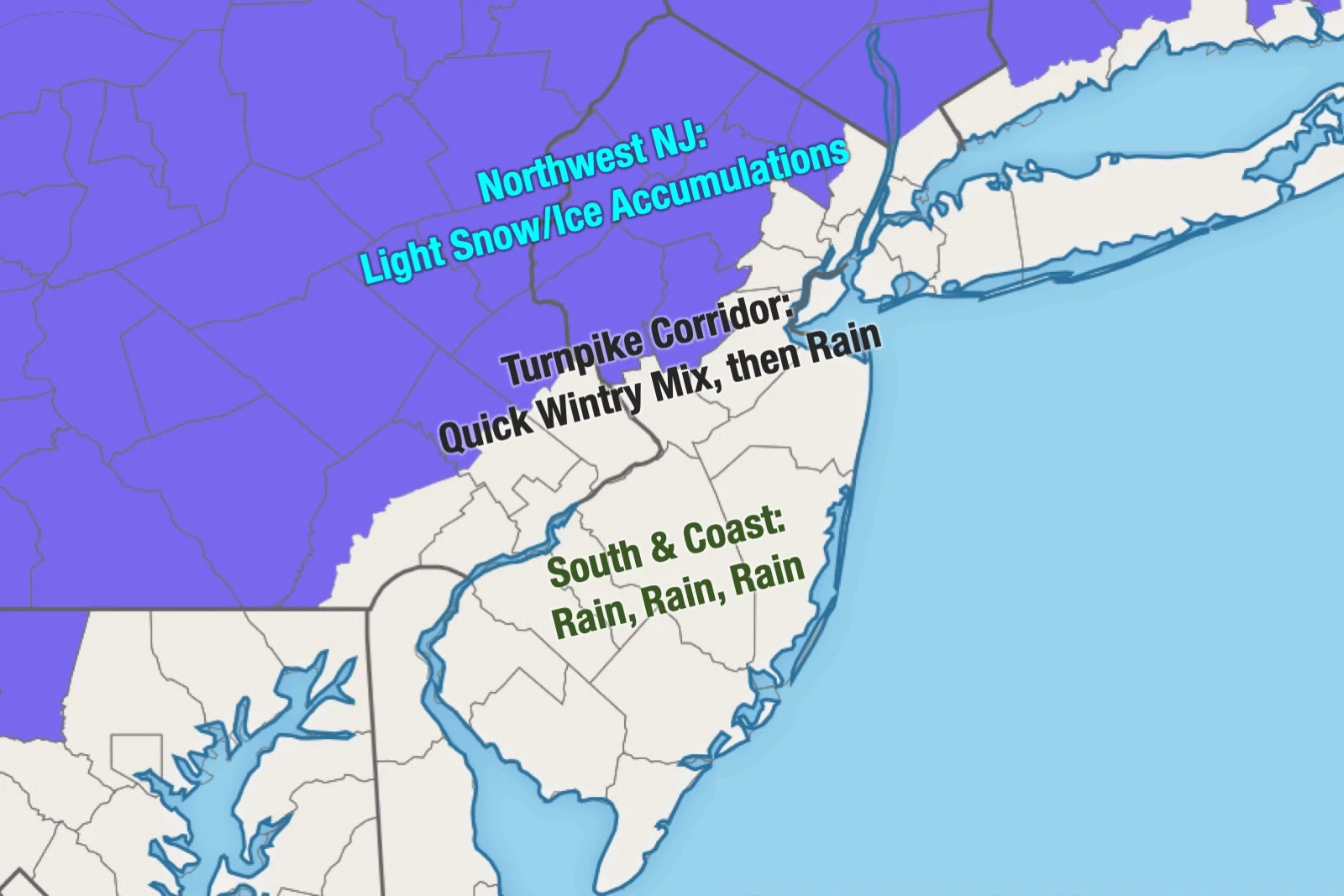
A Winter Weather Advisory has been issued for northern and western sections of New Jersey, where light snow/ice accumulations and slick road conditions are most likely:
—9 a.m. Sunday to 1 a.m. Monday for Hunterdon, Morris, Somerset, Sussex, and Warren counties.
—9 a.m. Sunday to Midnight Monday for western Bergen and eastern Passaic counties.
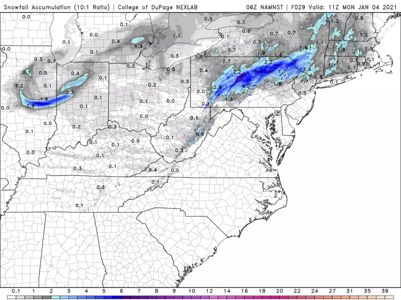
The advisories are mainly posted for the threat of light icing, not really for travel-inhibiting snowfall. I still think there's a chance of 2 to 3-ish inches of snow at the most. But that's only in the higher elevations of far northwestern New Jersey, where temperatures may stay cold enough for an all-snow event.
Meanwhile, southern and coastal New Jersey will see just plain rain for the duration. Rainfall totals will likely end up between a half-inch and an inch.
As of this writing (7 a.m.), rain has bubbled up into southwestern New Jersey, right on schedule. By 11 a.m., we should see pockets of precipitation throughout the Garden State.
Obviously, temperatures are very important in dictating exactly what falls from the sky. Temperatures are cold enough west of the NJ Turnpike corridor to sustain a quick burst of wintry mix (snow, sleet, and rain) at the onset. You might even pick up a quick coating of snow on the ground. Reduced visibility and icy roads could become problems quickly through midday.
By early afternoon, the vast majority of New Jersey will be under rain. Liquid, cold, and unpleasant. The exception, as usual, will be the coldest corner of the state — approximately north of I-78 and west of I-287 — where snow and sleet could hold on a bit longer, leading to light accumulations. Up to a tenth of an inch of ice accretion and/or 2+ inches of snow accumulation are possible, especially in colder higher elevation areas. (FYI, the Poconos in NE Pennsylvania could see several more inches of snowfall.)
No significant wind is expected, although it may turn breezy at times. The coastal flooding threat is fairly low — tidal guidance shows water levels briefly poking past minor flood stage during Monday morning's high tide cycle.
The yucky weather will continue into Sunday night. As temperatures drop, the rain-snow line may drift to the south again, perhaps encompassing the northern third of NJ by early Monday morning.
As dawn breaks Monday morning, it will be all over. There could be some residual slippery spots, but nothing to write home about.
Aside from a rain/snow shower chance on Tuesday, it will generally be a quiet and seasonable first full week of January. The next storm system worth watching is in the Friday-Saturday time frame.
So a good day to catch up on housework, watch a movie, cook a nice dinner, etc. If you do venture out, please remain vigilant, stay smart, and be safe.
Dan Zarrow is Chief Meteorologist for Townsquare Media New Jersey. Follow him on Facebook or Twitter for the latest forecast and realtime weather updates.
More From 105.7 The Hawk


