
Tornado Watch issued for western NJ until 10 p.m. Tuesday
Update, 10:30 p.m. Tuesday: 'Probable tornado' in North Jersey, water spout in South Jersey
In our forecasts all day, we have been warning of the potential for strong to severe thunderstorms from Tuesday late afternoon through evening. We're getting close to storm time, and the atmospheric parameters are coming together for some loud and potentially dangerous weather over New Jersey.
The National Weather Service has taken the step of issuing a Tornado Watch for 6 counties in western New Jersey: Burlington, Camden, Gloucester, Hunterdon, Mercer, and Warren. The watch is in effect until 10 p.m.
A Tornado Watch means severe weather - including tornadoes, wind, hail, and flooding - is likely to occur. It does not mean you need to seek shelter immediately, nor that a storm is guaranteed to hit you — it is just a formal "heads-up" for potentially dangerous conditions.
Given the latest model trends and the warmth/humidity of our rapidly destabilizing atmosphere (across SW NJ in particular), I must say I am concerned about several discrete severe thunderstorms impacting the Garden State through this evening. There is a legitimate chance of a tornado in/around NJ, in addition to 60+ mph damaging winds, small hail, and blinding rain.
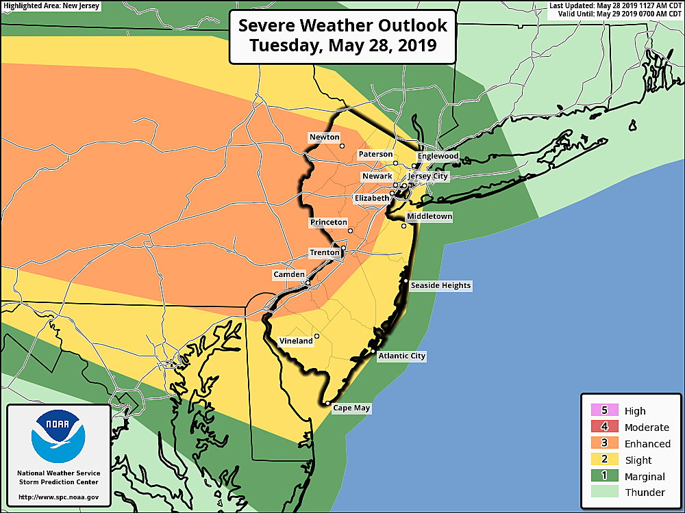
To put a finer point on the storm threat, the Storm Prediction Center estimates a 5% tornado risk, a 30% wind risk, and a 30% hail risk for the watch area in western NJ.
The latest timing forecast puts strong thunderstorms over the state between about about 4 p.m. and 10 p.m. Tuesday. Fading storms and showers may linger through early Wednesday morning. As storms approach, additional watches may be needed to the east and south.
Since these powerful thunderstorms will coincide with the evening rush hour, it's important to stay "weather aware". That involves three important steps:
1.) Know there is a risk of severe weather. By reading my blog, you can check this step off your list — but please make sure your friends and family are aware of the storm chance too.
2.) Have a way to receive weather warnings as they are issued. Radio is good, app is better.
3.) Take action quickly if you're in the path of a nasty storm. This may include delaying or detouring your ride home, seeking shelter in a sturdy building, etc.
More From 105.7 The Hawk


