Rain, snow, wind, cold: ‘Winter’s last gasp’ this weekend for NJ
I think Thursday's weather blog post, "Yes, there is a legitimate chance of snow in NJ this weekend", was well-received and understood. Sure, we could still see some snowflakes as we dive into this May weekend.
Here are the reasons I am not concerned in the slightest about this taste of winter weather:
—It will be light.
—It will be brief (mostly rain).
—Snowfall will be geographically limited (mainly NW NJ).
—It will happen during the overnight hours.
—The ground will be too warm and wet for snow to really stick.
—It is coming over the weekend.
—We are staying-at-home and socially-distancing.
Here are the reasons this storm system is fascinating, and deserves some extra attention:
—It's freakin' May.
—Saturday's cold and wind will be unseasonable and uncomfortable.
We'll begin this Friday morning with breaks of sun and temperatures in the 40s (inland) to lower 50s (coast). Dry for now, rain showers will start knocking on our door in the 10-11 a.m. time frame. (I'm calling the start time Friday midday or "lunchtime".) As scattered showers spread across the state Friday afternoon, high temperatures will range from 50 to 60 degrees, from north to south.
Rainfall will become steadier and heavier by Friday evening, starting around 4-5 p.m. We'll get soaked with about a half-inch of rain overall, give or take, before it tapers off early Saturday morning (2 a.m.-ish).
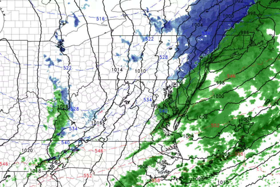
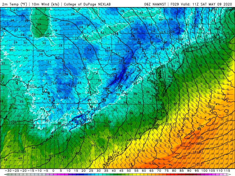
It is the tail-end of that storm system that could bring a period of light snow or wintry mix to the Garden State early Saturday morning. Our latest forecast models have admittedly backed off the idea of widespread snowflakes here. But it's still reasonable to keep the chance alive in the forecast, especially with thermometers plummeting into the 30s overnight. (A widespread frost or freeze, wind chills in the 20s — brrr!) The threat for a dusting or coating of accumulation will be strictly limited to the northwest corner of the state (Sussex, western Passaic, Morris, and Warren counties).
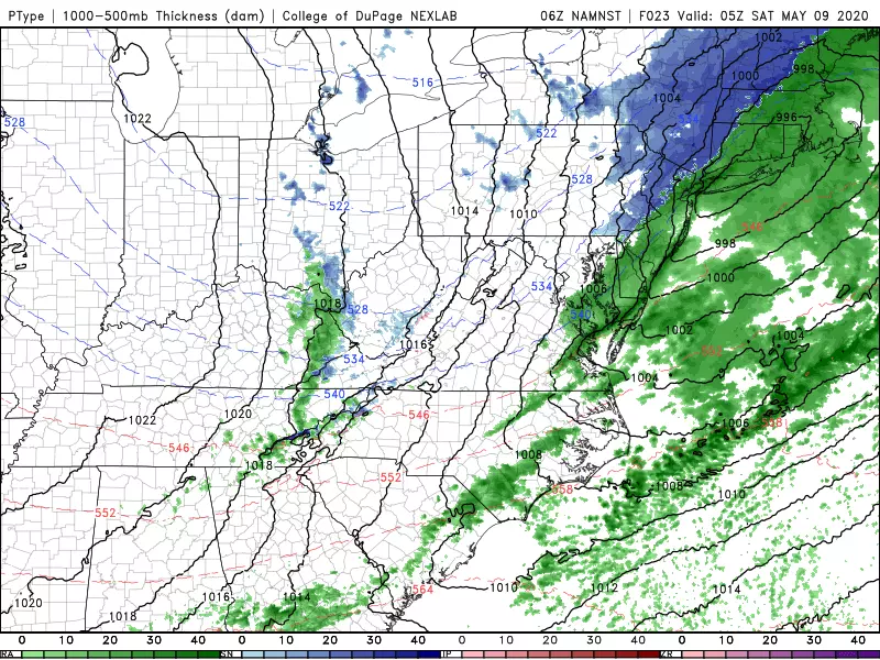
Meanwhile, northern New England is expected to see a half-foot of snow from this storm system.
No matter what falls from the sky, Saturday is going to feel like a wintry day. Despite plenty of sunshine, high temperatures will only reach the upper 40s to around 50 degrees. (That's it!) Wind gusts to 40 mph will make it feel quite blustery too. (Bundle up!)
In addition, as we've seen a few times already this spring, that strong northwesterly wind could spark some snow showers or snow squalls Saturday afternoon. I wouldn't rule out a quick burst of snowflakes anywhere in the state. (Although just to be clear, not everyone will see snowflakes this weekend. No way.)
Mother's Day Sunday will clearly be the warmer, nicer day of the weekend. It will still be breezy, with 30 mph wind gusts possible. Following another early morning frost or freeze, mostly sunny skies and dry weather will help pop thermometers to about 60 degrees.
On Monday, we'll see a mix of sun and clouds with a round of late-day rain showers. Highs scale back slightly into the upper 50s.
And then a pair of sunny pairs is in the forecast for Tuesday and Wednesday. Even so, we'll remain stuck in a cool air mass, so temperatures will come shy of seasonal normals yet again. 60 on Tuesday, mid 60s Wednesday.
Long-range models are still showing a big warmup exactly one week away, next Friday-Saturday. Unfortunately, the latest guidance shows some unsettled, wet weather associated with that warmup. But that gives extra credence to the assertion I made in the headline of this post. This has to be Ol' Man Winter's grand finale, the last blast of cold air, arctic wind, and snowflakes for the 2019-2020 season.
After all, Memorial Day is only 17 days away. The Summer Solstice is 43 days away. It is time to warm up!
Have a wonderful weekend. Stay warm, stay safe, and stay healthy, my friends!
Dan Zarrow is Chief Meteorologist for Townsquare Media New Jersey. Follow him on Facebook or Twitter for the latest forecast and realtime weather updates.
More From 105.7 The Hawk