Nasty nor’easter impacts NJ Thursday and Friday: Timeline and totals
UPDATE... This article is outdated...
For the latest winter storm forecast information, please refer to my newest weather blog post.
The Bottom Line
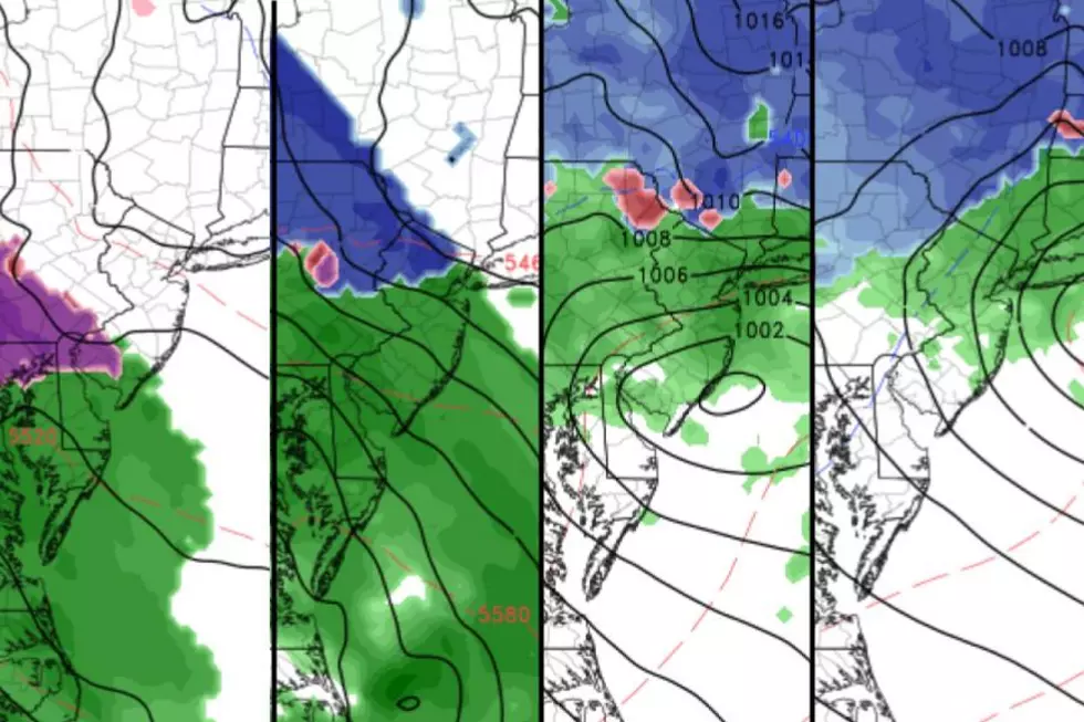
Rain, wind, snow, ice, and coastal flooding are all in the forecast for New Jersey over the next 36 to 48 hours.
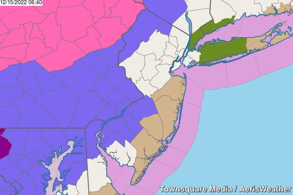
Not everyone will see wintry weather from this powerful coastal storm. There are only two concerns for treacherous travel from this storm:
1.) Away from the coast, watch for icy spots due to sleet and freezing rain in the first hour or two of precipitation.
2.) In northwestern New Jersey, snow will be the predominant precipitation type during the day Thursday, leading to light accumulations.
Also worth noting, the "brunt" of the storm has slid a bit earlier. The worst weather is now centered on the afternoon and evening hours.
And this system is going to linger for quite a while on Friday. Expect another unpleasant day.
Following the nor'easter, we will fall into a dry, bright, cold weather pattern for the weekend and most of next week.

Timeline
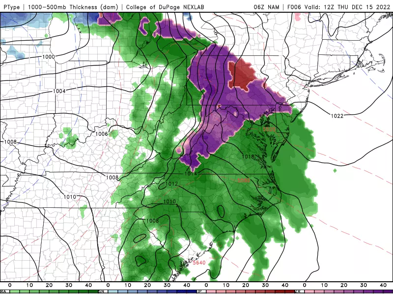
—Thursday morning... As of this writing (6 a.m.), rain is pushing into southwestern New Jersey. It will continue spreading north and east through late morning. There is still a risk of a brief hit of sleet or freezing rain within the first hour or two of onset, especially along the I-295 corridor in SW NJ.
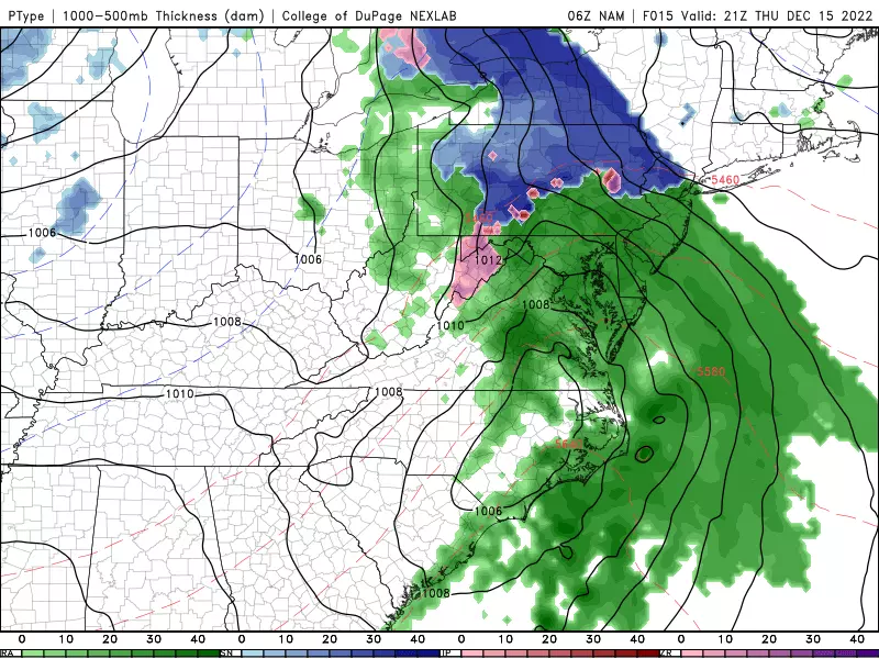
—Thursday afternoon... Bands of steady to heavy rain continue, as winds ramp up. Snow falls and potentially accumulates in NW NJ only. (North of I-78, west of I-287.) High temperatures will reach the mid 30s (North Jersey) to mid 40s (South Jersey).
—Thursday evening... Rainy. And windy, with top gusts over 40 mph along the coast. Temperatures will hold steady or rise slowly, mainly through the 40s.
—Thursday late night... After midnight, the rain should start to break up a bit. Still pretty miserable, with low visibility and big puddles.
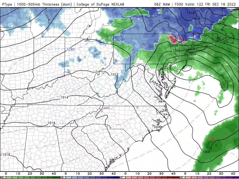
—Friday morning... Still pretty yucky. Scattered rain continues for most of the state through the first half of Friday. Still pretty windy too. Outside of colder North Jersey, temperatures across most of the state will spike to near 50 degrees.
—Friday afternoon... Rain finally starts to break apart, and the wind finally (slowly) starts to calm. Temperatures will start to drop too, possibly into the upper 30s by sunset.
—Friday night... Final raindrops exit by around Midnight at the latest. Skies will quickly clear overnight. Low temperatures will dip to around the freezing mark by Saturday morning — not cold enough and not long enough to worry about a "flash freeze".
Totals
—Rain... 1 to 2 inches for most of the state. Guidance has actually crept rainfall totals upward slightly — some spots could even see over 2 inches of rain. That's a lot.
—Ice... Again, the ice concern is limited in time and geography. A light glaze of ice is possible, especially to the south and west. That's more than enough to cause slippery spots through the Thursday morning commute.
—Snow... Northwestern New Jersey only could see a few inches of snow accumulation. Let's say up to 4 inches. A lot more than that will fall, but will melt. This is the most precarious and low confidence part of the forecast.
—Wind... East-northeast gusts may exceed 30 mph inland and 40 mph along the coast. That is enough to cause driving difficulties, reduced visibility, and sporadic power outages.
—Coastal Flooding... Some water rise is expected for three consecutive high tide cycles — Friday morning, Friday afternoon, and Saturday morning. The middle one is the most precarious, with widespread minor to localized moderate category flooding of tidal waterways.
Advisories
—Winter Weather Advisory... 5 a.m. to Noon Thursday... northwestern Burlington, Camden, Gloucester, and Salem counties. A light glaze of ice possible.
—Winter Weather Advisory... Noon Thursday to Midnight Friday... western Passaic, Sussex, and Warren counties. Up to 4 inches of snow accumulation possible.
—Wind Advisory... 6 p.m. Thursday to 4 a.m. Friday... Atlantic and Cape May counties. Gusts may exceed 40 mph.
—Wind Advisory... 9 p.m. Thursday to 10 a.m. Friday... southeastern Burlington, Monmouth, and Ocean counties. Gusts may exceed 40 mph.
The Extended Forecast
Behind the storm, our weather finally quiets down for the weekend and much of next week.
Saturday has the makings of a nice December day, with sunshine and highs in the lower 40s.
Sunday will be the colder day of the weekend, only reaching about 40 degrees (give or take) with mixed sun and clouds.
Still dry for Monday, Tuesday, and Wednesday. However, high temperatures will remain on the cold side, struggling to reach the 40 degree mark.
Next storm system would not come until the late part of next week. (Reminder: Next weekend is Christmas Eve and Day.)
Dan Zarrow is Chief Meteorologist for Townsquare Media New Jersey. Follow him on Facebook or Twitter for the latest forecast and realtime weather updates.
Let it snow: 12 things to know about winter forecasting in NJ
30 unique 'experience' gifts New Jerseyans actually want to get
More From 105.7 The Hawk


