Isolated 3+ inches of snow possible along NJ coast Wednesday
It's a situation I have been watching since last week. In Tuesday's forecast, I presented a likelihood of snow showers for New Jersey's coastal counties on Wednesday. And now, we have to ramp that snow outlook up another step — a few inches of accumulation are possible somewhere in New Jersey.
Off the top of my head, in general, there are about 5 storm setups that bring snow to New Jersey:
--Nor'easter (Miller Type A)
--Nor'easter (Miller Type B)
--Alberta Clipper
--Cold Front
--Lake-Effect Snow (from the Great Lakes)
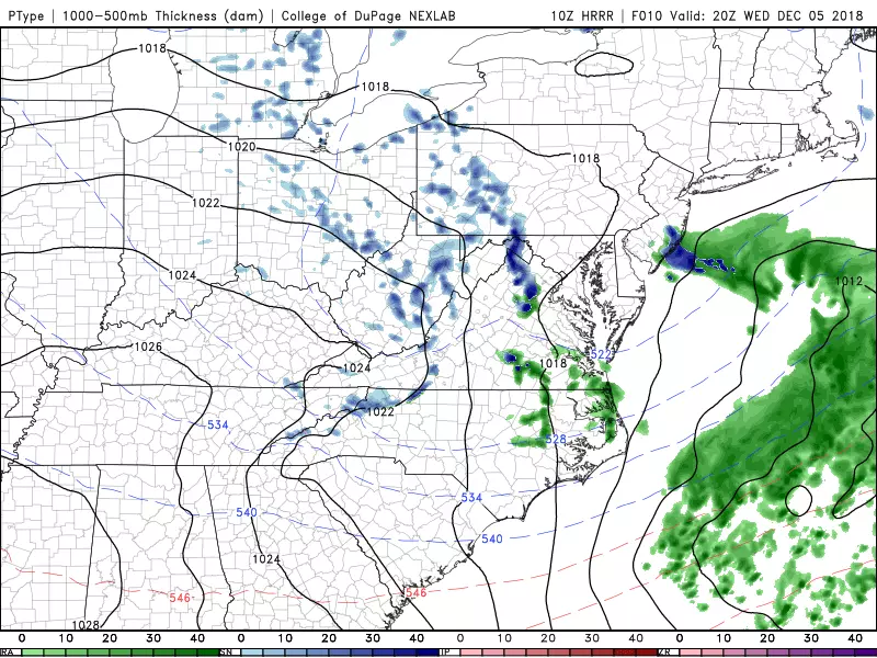
This one is a result of an "inverted trough" sitting off the Atlantic coast. It's weird. And it's complicated. The end result will be a very narrow band of snow invading the Jersey Shore.
--TIMING: Snowflakes could start as early as 6 a.m. Monday, potentially lingering as late as 7 p.m. Monday. It appears the time frame of heaviest snowfall will be Monday early afternoon.
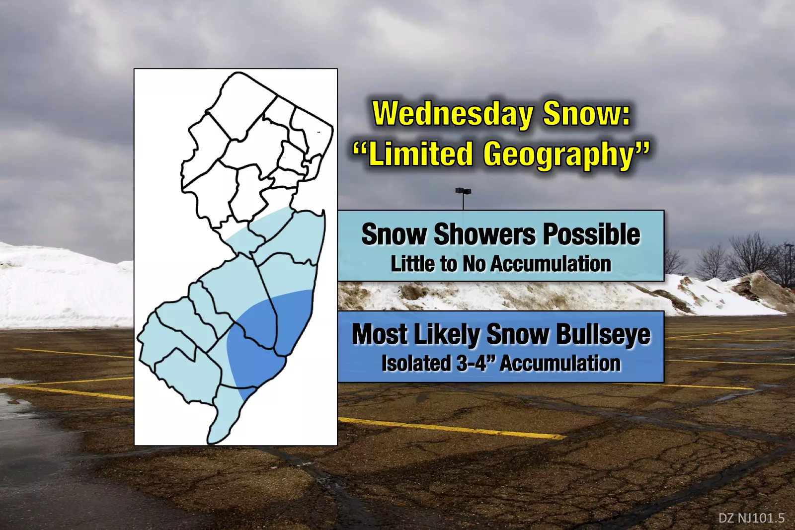
--ACCUMULATIONS: Model guidance has really ramped up potential precipitation totals over the last half-a-day. And while there could be some areas of rain complicating this forecast, I'm thinking the chilly temperatures will lead to mainly snow. I'm forecasting a top snow accumulation of 3 or 4 inches of snow. Note: that is a reasonable expectation, but the biggest snow will be very isolated — the vast majority of the state is expected to see little to no accumulation. (Also worth noting, I've seen raw model output paint over 7 inches of snow in that area. But it's going to be too warm for such a crazy snow ratio.)
--GEOGRAPHY: Here is the tricky (nay, impossible) part of this forecast. The "bullseye" for top snow accumulation appears to be from Ocean to Burlington to Atlantic countries. (Soooo let's just call it Tuckerton — it's going to snow in and around Tuckerton.) Of course, producing such a pinpoint snowfall forecast is invalid. It extends beyond the modern-day science of meteorology. So keep in mind, there is a requisite wiggle factor build in to every snow forecast — especially this one.. As I said, someone in New Jersey will see a few inches of snow accumulation Wednesday, but certainly not everyone.
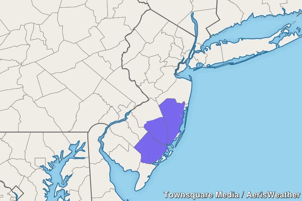
--ADVISORY: A Winter Weather Advisory has been issued for Ocean, southeastern Burlington, and Atlantic counties only, until 6 p.m. In other words, let the brining begin!
If you're not in Wednesday's snow zone, expect a mix of clouds and sun and chilly temperatures. We're seeing widespread 20s Wednesday morning, with forecast high temps about 35 to 40 degrees Wednesday afternoon.
As snow showers wrap up Wednesday evening, skies will become mostly clear once again. That sets us up for another cold night, with overnight low temperatures in the mid 20s. No wind to speak of, luckily.
Most of Thursday looks quiet, with partly sunny skies and a return of a stiff breeze (out of the southwest, up to 20 mph). High temperatures are expected to reach the lower 40s — still below normal by early December standards.
An approaching cold front will drag some snow through southern New York and northeastern Pennsylvania, but the latest forecast models do not show it impacting New Jersey. I think it's prudent to include a snow shower chance in NW NJ only for late-day Thursday. But again, "limited geography" is the name of the game.
Friday will be another cold day. Despite sunshine, high temperatures will only rise to around the 40 degree mark.
As we've discussed for several days, the weekend forecast gets complicated. To start, it's going to be very cold on Saturday. Under increasing clouds, high temperatures will only be in the mid to upper 30s. Despite the chill, it will be a quiet and dry weather day.

A sizable storm comes into view on Sunday. The storm's center is expected to pass through the Carolinas on Sunday. Previously, I was dubious as to whether this storm would bring precipitation to New Jersey. I hate to say it, but it is looking a bit more likely that snow and rain affect at least southern New Jersey from late Sunday into Monday.
The Euro model continues to show the furthest north trajectory for this storm. But even the GFS has "wiggled" closer to the Garden State over the past few runs. Could it wiggle back away from New Jersey again? Absolutely! Could it wiggle closer and provide some significant wintry weather? Yup.
We're still 4+ days away from this one, so I'm still not quite ready to specifically break down timing and potential accumulations. The precipitation type forecast is particularly complicated here, with a mix of snow and rain is possible as temperatures dance on either side of the freezing mark.
Obviously, we'll continue to watch this weekend storm situation carefully. And you should too.
Dan Zarrow is Chief Meteorologist for Townsquare Media New Jersey. Follow him on Facebook or Twitter for the latest forecast and realtime weather updates.
More From 105.7 The Hawk