
As cold air returns, will weekend storm bring rain or snow to NJ?
UPDATE... This article is outdated...
For the latest winter storm forecast information, please refer to my newest weather blog post.
The Bottom Line
We are riding a weather roller coaster this week here in New Jersey. As of Thursday, we are right at the top of the biggest hill - the nicest, warmest day of the week! But temperatures are set to plummet again heading into the start of the upcoming weekend. And then things get even more wild and exciting with a powerful storm system looming at the end of the weekend.
Three separate weather headlines to talk about here, each delivering a different flavor of "January" weather. Let's dig into each, with particular attention on the Sunday-Monday storm that is becoming more and more likely to have some impact on New Jersey. (Meaning rain, ice, snow, wind, and/or coastal flooding.)
Weather Headline #1: A Pleasant Thursday
All in all, Thursday will be a nice mid-January day across New Jersey. It won't be "warm" - morning temps are in the 20s and 30s, and highs will be limited to the mid 40s. But that is above-normal for this time of year. Combined with breaks of sun, light winds, and dry weather (aside from flurries), there is a lot to like here.
Clouds will thicken up through Thursday evening. And some light fog may develop overnight. Low temperatures will dip into the lower to mid 30s. Maybe a frost, maybe a freeze - chilly, but not frigid.
Weather Headline #2: Another Big Cooldown
It is worth mentioning that a broad storm system will be passing well off-shore early Friday morning. Latest model guidance suggests a few rain showers may brust against New Jersey's coastline. They look light and brief.
Otherwise, Friday starts quiet. And high temps should reach the lower 40s or so by lunchtime. This concludes our latest period of quiet, pleasant weather.
That's because another arctic cold front will introduce a gusty north wind and cause temperatures to tumble from Friday afternoon through Friday night.
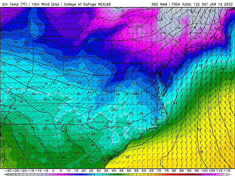
By Saturday morning, I suspect we're going to see temperatures in the single digits across interior New Jersey. Possibly with (dangerous) below-zero wind chills, if the gusts don't die down.
High temperatures on Saturday will only reach the lower 20s. Just as frigid as Tuesday was, with mostly sunny skies, but hopefully less windy.
Weather Headline #3: Weekend Storm System
First of all, a programming note. I am having a hard time deciding what to call this thing. It's almost a "nor'easter" or "coastal storm," but the inland type and the hype-ish nature of that term aren't really appropriate. It may or may not be a "winter storm" for New Jersey, depending on precipitation type. So I'm settling on a generic "storm system" description for now.
Most of Sunday looks fine. Temperatures moderate, with highs pushing into the mid 30s. Early sunshine will give way to thicker clouds in the afternoon.
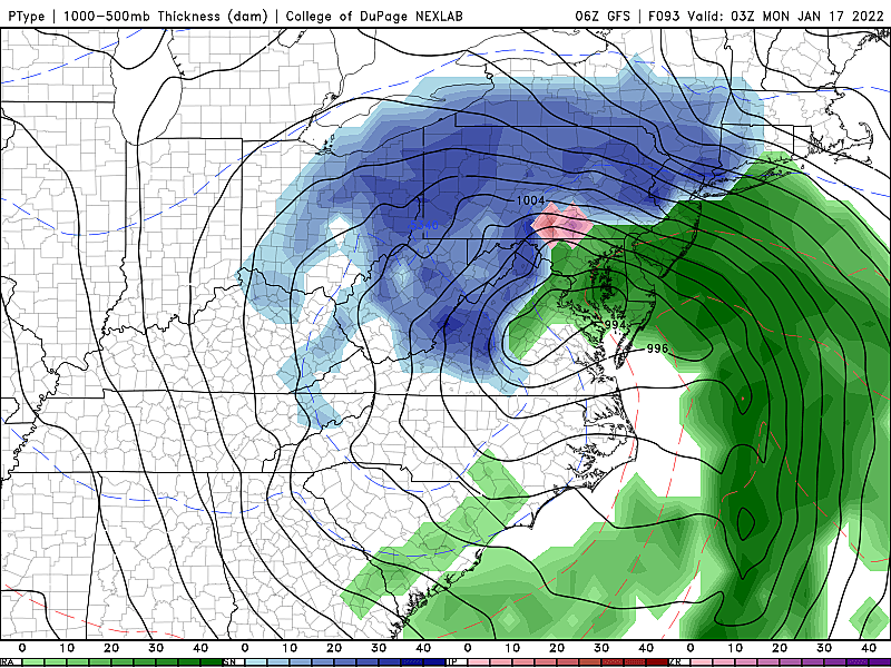
--Timing... The start time for any kind of inclement weather looks to be no earlier than about 4 p.m. Sunday. The nastiest weather will occur overnight, around 2 a.m. And then things will wind down after sunrise, with final flakes/drops by Monday late morning, around 11 a.m.
--The Challenge... A powerful storm system is coming ashore in western Canada Thursday. In the coming days, that area of low pressure will dig deep to the south. Snow accumulations may reach as far south as Georgia. Then the storm will take a hard left turn, paralleling the U.S. East Coast. And that's where things get tricky - the exact road the center of the storm takes will dictate who in the Northeast gets snow and who gets rain. Therefore, at this point - about 3 and a half days before "first flakes" - we have to talk about a few scenarios that could play out.
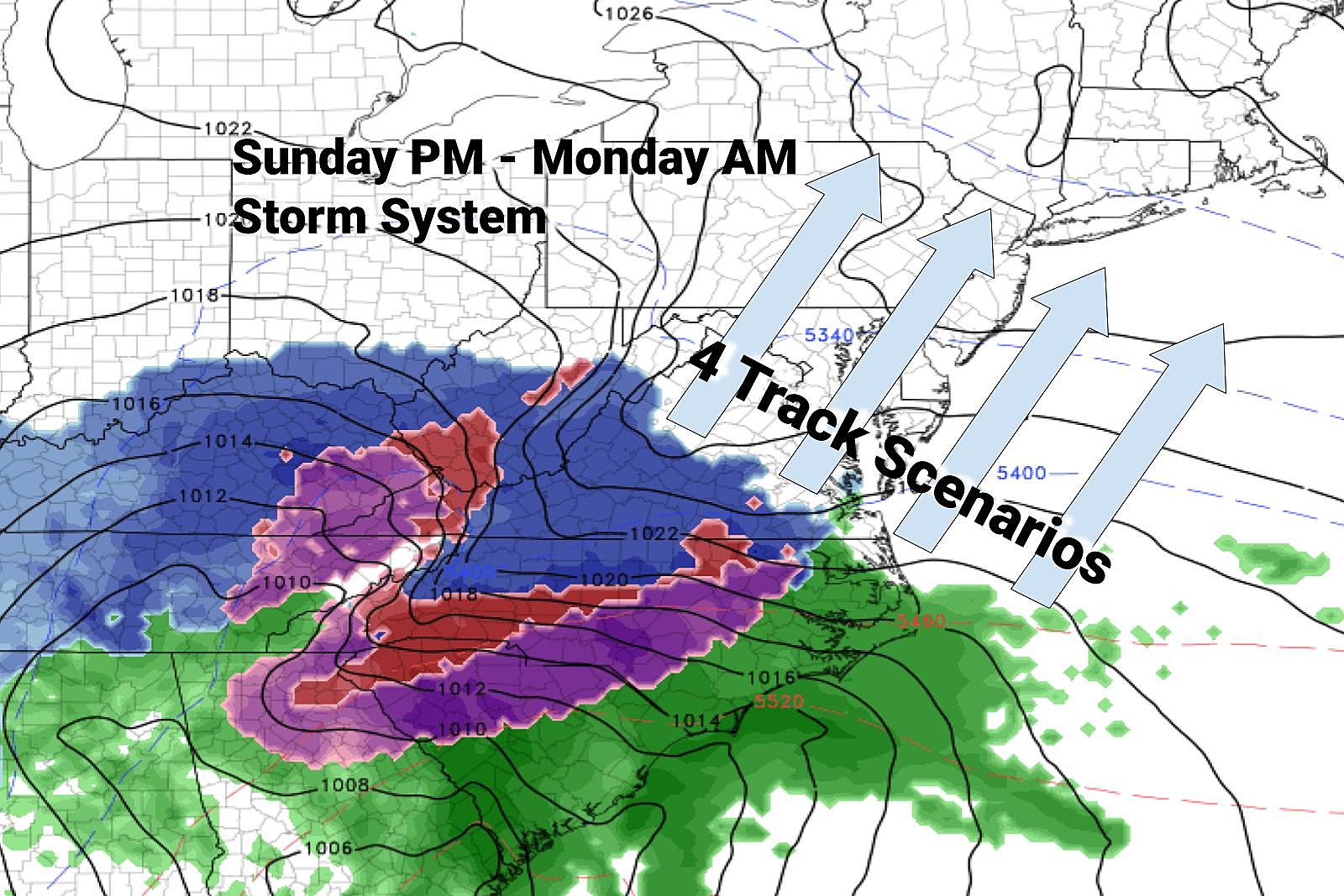
--Scenario #1: Mainly Rain... A far inland track would keep New Jersey on the warm side of the storm. As frigid as it will be on Saturday, temperatures would surge to near 50 during the height of the storm. That is way too warm for frozen precipitation. So we'd end up with an inch or two of rain, rain, rain.
--Scenario #2: Snow to Rain... This would be the messiest forecast for New Jersey. And given the last few model runs, it is probably the consensus (most likely) outcome at this point. If the center of low pressure tracks directly over New Jersey (i.e. along the I-195 / Turnpike corridor), the warmer coast would probably see a rainy situation (similar to scenario #1). However, all inland areas would be under the gun for a quick burst of snow Sunday evening, followed by a transition to wintry mix and possibly all rain through Monday morning. If that warming transition isn't fast and clean enough, there could some icing worries too. The geography and timing here gets very tricky, in terms of who would see snow accumulation and how much. If NW NJ stays all snow for the duration, heavy double-digit accumulations would be possible.
--Scenario #3: Snow Bomb... A shift of about 50 miles east would put the center of the low over the Atlantic Ocean. Not only could that keep the system fueled with abundant moisture, it would put New Jersey firmly on the cold side of the storm. A proper nor'easter, leading to significant snowfall. To be clear: I have not seen this outcome on any recent model forecasts. But it is a possibility we have to keep in mind, given the potential for big impacts.
--Scenario #4: A Total Miss... Also an unlikely scenario at this point, as the storm would have to swing wide right to completely miss us. Stronger high pressure over Canada and a weaker high over the Atlantic would allow the storm to shift well off-shore. Leading to colder temperatures for the Garden State, but little to no precipitation.
--What's Next... Over the next 12 to 24 hours, we will continue to refine this forecast. What I'll be looking to do is rule out some of these scenarios. Then (and only then) we can focus on details like a storm timeline, snow/ice accumulations, travel impacts, etc. Please understand this is one of those storms that presents a very tricky forecast - uncertainty will be high until about 24 to 48 hours before it arrives.
Dan Zarrow is Chief Meteorologist for Townsquare Media New Jersey. Follow him on Facebook or Twitter for the latest forecast and realtime weather updates.
NJ's Route 22 circa 1984 — Do you recognize these businesses?
Gallery Credit: Joe Votruba
What you like most about living in New Jersey, according to Reddit
Gallery Credit: Joe Votruba
More From 105.7 The Hawk


