NJ weather: Ian rain and wind day 5 of 6, one more big high tide
The Bottom Line
It's. Still. Raining.
The center of circulation of "The Remnants of Ian" is sitting about 100 miles southeast of New Jersey. As it makes its closest pass to the Garden State, we face more wet and windy weather. Maybe some thunderstorms. And more serious coastal flooding concerns too.
Top rainfall totals along New Jersey's southern coast are now passing 7 inches. That's a lot of water — there are some big puddles out there. And we still have another day and a half of rain to go.
However, it is also important to point out that North Jersey has seen considerably less rain — as little as a tenth of an inch in Sussex County (as of early Tuesday morning). But that changes quite a bit Tuesday, as the axis of steadiest, heaviest rain shifts farther north.
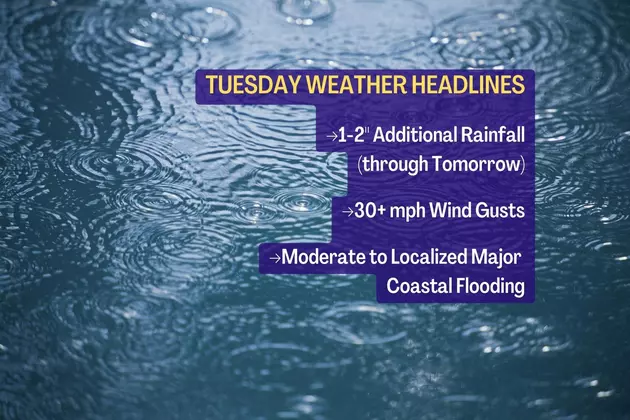
We could squeeze out another inch or two of rain between Tuesday and Wednesday, before this storm system finally kicks out to sea. Wind gusts of 30+ mph are still likely, especially near the coast. And 2 to 3 feet of storm surge will once again produce widespread moderate flooding of tidal waterways at high tide. The flooding will be particularly bad on barrier islands, which are surrounded by ocean and bay water.
Raindrops slowly taper off Wednesday afternoon and evening. Thursday will be a spectacular day.
Tuesday
Overnight, North Jersey got soaked and South Jersey got a break. But there is plenty more wet weather to come, as waves of rain slide through New Jersey all day Tuesday.
We also tap into slightly more moist and unstable air, raising the possibility of embedded thunderstorms. I don't think the severe weather parameters are high enough to ring alarm bells for gusty winds, hail, and/or tornadoes though.
It will be wet and windy and cloudy and cool. High temperatures will only climb into the lower 50s Tuesday afternoon. By the way, that is almost 20 degrees below normal for early October. It feel like Thanksgiving time.
As 4 to 8 foot waves continue to batter the Jersey Shore beaches, we have already seen some significant erosion. And the coastal concerns continue Tuesday.
The next high tide cycle will be the second and final "really big" one. 2 to 3 feet of surge will exceed "Moderate" flood stage, and may approach "Major" flood stage along the southern coast (Ocean, Atlantic, Cape May counties). This will be similar to — if not slightly higher than — Monday afternoon's crest.
High tide will be around the 3 p.m. hour along the Atlantic Ocean, 6 p.m. for back bays and lagoons, and 9 p.m. up the Delaware River.
As we move into Tuesday night, the rain shield should once again break apart a bit. And winds should calm to the "breezy" zone. Temperatures won't budge more than a couple of degrees overnight, holding in the lower 50s.
Wednesday
The big transition day, featuring improving weather! (Eventually.)
Scattered rain will still dampen your spirits Wednesday morning. But starting early afternoon, raindrops will start to taper off and move off-shore. By dinnertime, I think the entire state will be drying out. (I can't really pinpoint "who clears out first," because it depends on the location and orientation of the final few shower bands.)
I do not expect the sky to clear much until Wednesday evening. But with the reduction in rain coverage, at least high temperatures should push closer to 60 degrees Wednesday afternoon.
Thursday
All good.
On Thursday, we will enjoy mostly sunny skies, lighter winds, calmer seas, dry weather, and warmer temperatures. What a perfecta. High temperatures will push into the 70s across the state, making for a beautiful October day.
Friday
Most of Friday looks good. However, it is a cold front day, which could have some impacts on our weather.
We'll start with sunshine and fair-weather clouds. High temps should once again reach into the lower to mid 70s.
Around the early to mid afternoon hours, a few showers and sprinkles may clip northern New Jersey. And then it will get breezy, with a northwest wind kicking up to 20 mph. Not ferocious, not damaging, not an "arctic blast". Just a noticeable change in the air.
The Extended Forecast
We head into the holiday weekend with a burst of cold, crisp air.
Saturday morning could be the coolest morning of the season so far, potentially bringing frost to patches of NW NJ, with low temperatures in the upper 30s to lower 40s. Afternoon highs will struggle to reach 60 degrees. However, unlike our recent stretch of soggy, gloomy weather, dry air and sunshine will make for a pleasant fall day.
Sunday morning gets even cooler. Morning lows near 40 may have you reaching for the heater. Afternoon highs in the lower 60s still put us in "jacket weather" territory.
Seasonable 60s and 70s look to be the story of next week. Another cold front and temperature knockback is forecast for around the midpoint of October. That one could put all of non-coastal New Jersey in the frost zone for the first time this season.
Meanwhile, the tropics are far from quiet. There are no named storms in the Atlantic, although there are two tropical waves under investigation between Africa and the Caribbean. The next names on the list for 2022 are Julia and Karl.
Dan Zarrow is Chief Meteorologist for Townsquare Media New Jersey. Follow him on Facebook or Twitter for the latest forecast and realtime weather updates.
LOOK: The most expensive weather and climate disasters in recent decades
Gallery Credit: KATELYN LEBOFF
11 years later — Sandy makes landfall in New Jersey
More From 105.7 The Hawk
