More rain Tuesday, flipping to snow Wednesday AM – but will it stick?
The question in the headline of this post is semi-rehetorical. (The answer is probably yes.) Tuesday will be wet. But Wednesday morning will turn wintry across New Jersey. This is a system where the biggest impact will not be snow totals, but rather bad timing. Although snow accumulations will be limited, a combination of low visibility and slushy conditions could make for a majorly messy Wednesday morning commute.
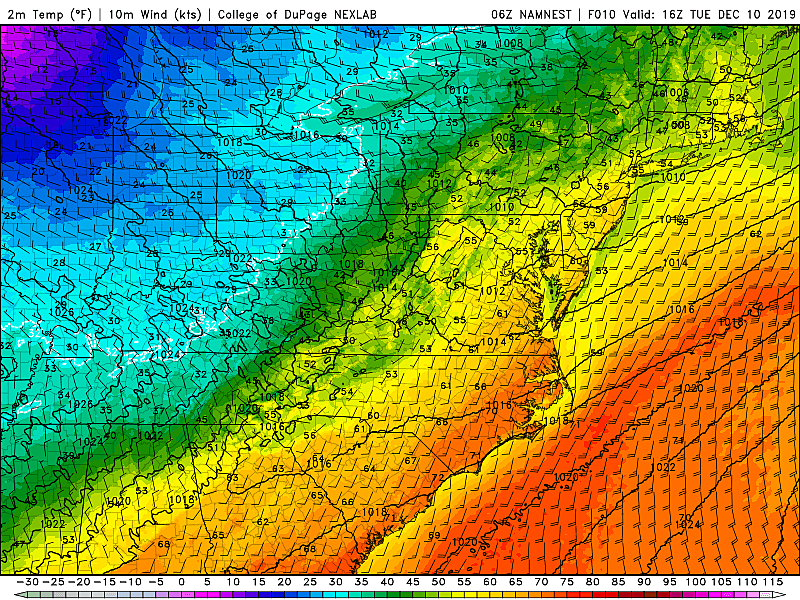
As of this writing (5:30 a.m. Tuesday morning), the radar is quiet and it is ridiculously warm outside. With the exception of Sussex County in far North Jersey, temperatures are in the 50s — that is 5 to 10 degrees above our normal high temperature for early December!
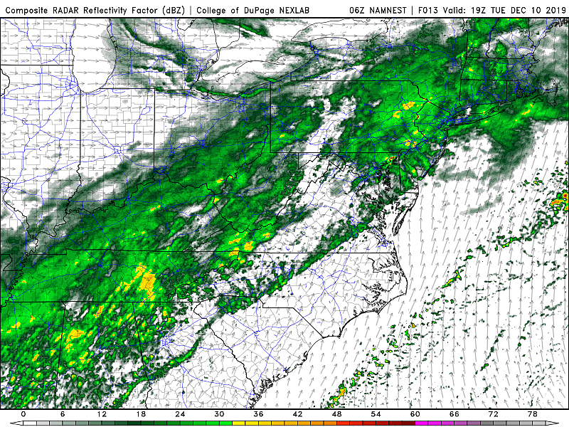
Roads are damp, and we'll see a few dollops of drizzle and scattered sprinkles early on. It looks like steadier rain will return from about Tuesday midday through the afternoon. That rain should not be as driving and drenching as on Monday, with additional rainfall totals generally between a half-inch and an inch. (Most of NJ was soaked by over an inch of rain on Monday.)
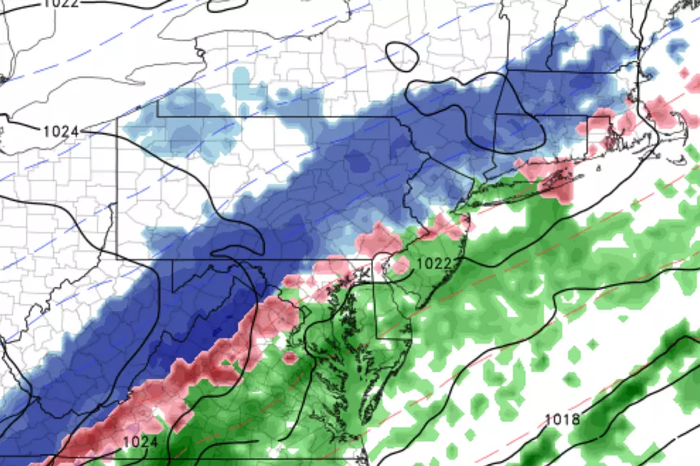
High temperatures will reach about the 60-degree mark Tuesday. However, those temps will start to slip through Tuesday afternoon. And then thermometers will really drop sharply as Tuesday evening falls. That means we'll see a flip from rain to sleet/snow — eventually.
For northwestern New Jersey, that transition will happen Tuesday late evening (around 10 p.m.) For most of New Jersey, things will turn wintry early Wednesday morning (around 2 a.m. give or take). And along the southern coast, you'll probably remain wet instead of wintry through daybreak Wednesday (6 a.m.-ish).
As I mentioned in Monday's weather blog post, snow accumulation will be slow to get started Wednesday because of the very wet and relatively warm ground surface. If it weren't 60 degrees on Tuesday, I would believe the model output suggesting 4+ inches of snow. But I'm confident that ain't gonna happen — the ground is too warm, and the air will dry out too quickly.
However, Wednesday morning's commute still looks like a mess. Snowfall may be heavy for time, especially if you believe the GFS model solution. Best-case scenario, you'll face low visibility due to falling snow. Grassy and cold surfaces will end up white across most of the state. Worst-case scenario, snow will semi-stick to road surfaces, making for a slippery ride.
I believe many school districts will have to make a last-minute call on whether to delay or even cancel school on Wednesday.
We could see some slushy accumulations out there, especially away from the coast. As usual, we have to estimate where the heaviest snow bands will set up. That is combined, of course, with the uncertainty of how much snow will actually stick and accumulate on the ground.

I've painted an area of 1 to 3 inches of snowfall for northwestern New Jersey — that's where the rain-snow transition will happen first, and where the ground surface will be slightly colder at onset too. On either side of the NJ Turnpike corridor, from Philadelphia to New York, a coating to 2 inches is possible — it definitely looks wintry for several hours. And for southern and coastal New Jersey, I'll put up to an inch of slush in the forecast — you will see snow, but it arrives late and falls on the warmest ground in the state.
I also included snow start and end times on the map above. Snowfall will start to taper in NW NJ just after sunrise Wednesday. This storm system will finally exit the state for good by Wednesday late morning.
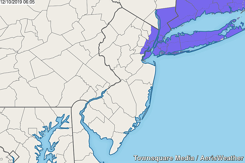
A Winter Weather Advisory has been issued for eastern Bergen, eastern Essex, Hudson, and eastern Union counties from 3 a.m. to 11 a.m. Apparently, 2 inches of potential accumulation is enough to spark an advisory.
Wednesday afternoon will quickly grow brighter as the sun comes out. But it is going to be colder, with temperatures stuck in the upper 30s, at best. What a difference — a full 25 degrees colder than the day before! Icy spots will be possible right through Wednesday night.
The core of our next cold air mass will sit on top of the Garden State on Thursday. Morning lows will dip into the 20s, with a wind chill ("feels like" or "apparent" temperature) firmly in the teens. Highs will only reach the mid 30s, despite sunshine and dry weather.
And we barely have time to catch our breath before another storm system arrives in New Jersey. We're eyeballing late Friday to early Saturday as prime time for rain. Yes, this storm system will once again carry (relatively) warm air into the Northeast, so we're looking wet and not wintry to start the weekend.
The next next storm system down the line is scheduled for Monday-Tuesday-Wednesday. Too soon for details, but this one could get interesting. While it may start as rain, an extended changeover to snow could lead to another taste of wintry weather. Just something to watch for now.
I'll probably put out a quick update Tuesday afternoon regarding our late night and early morning snow potential. Until then, enjoy the warmth and the rain — umbrellas up!
Dan Zarrow is Chief Meteorologist for Townsquare Media New Jersey. Follow him on Facebook or Twitter for the latest forecast and realtime weather updates.
More From 105.7 The Hawk