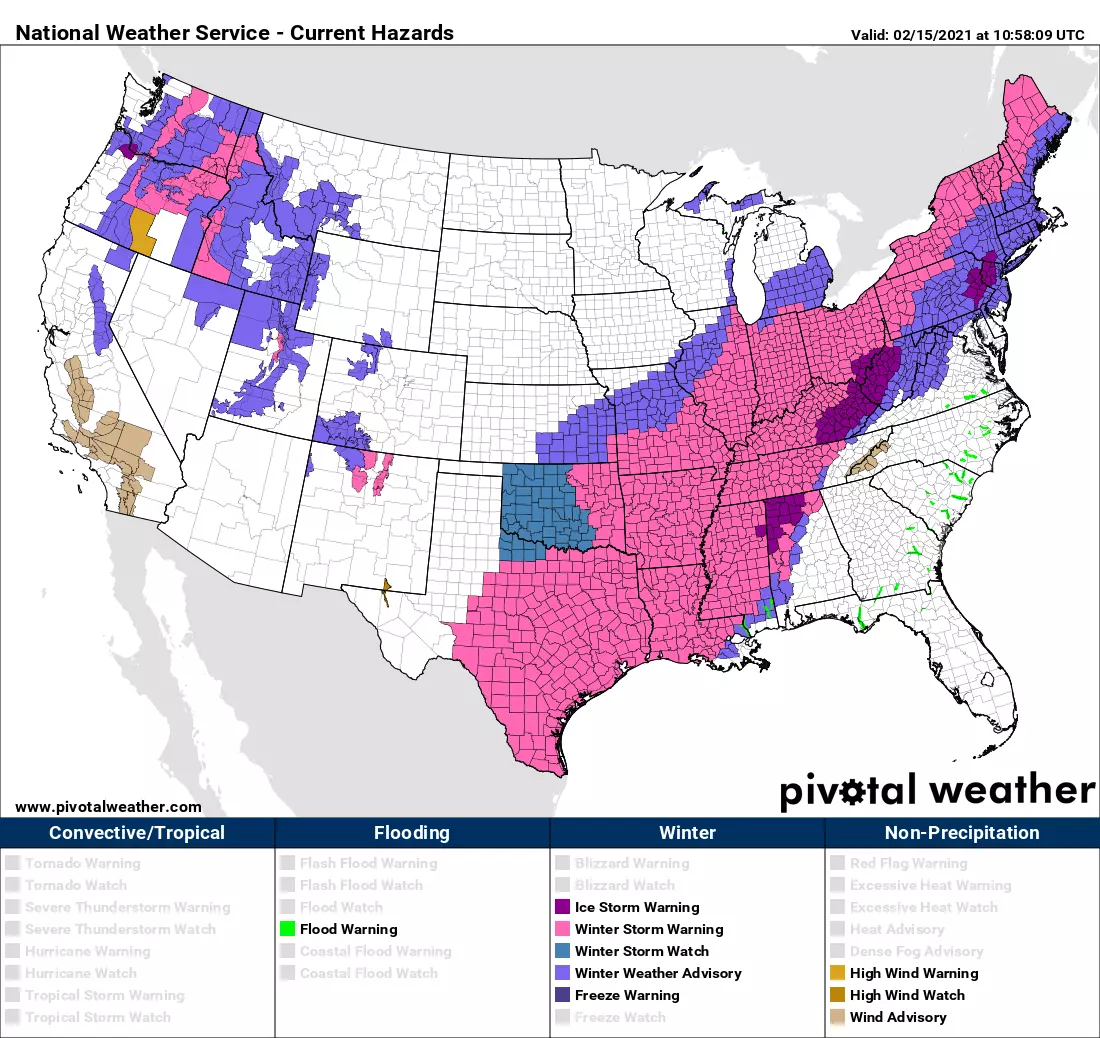
Ice Storm Warning: 1st of two storms this week another ice-maker, especially for NW NJ
I hate ice storms. I'm tempted to just copy and paste that sentence over and over again in this blog. Not everyone in New Jersey will see legit "ice storm" conditions from our latest storm system. But model guidance still looks pretty scary for northwestern New Jersey Monday night.

And, of course, that's not the only winter storm we're watching this week. Thursday looks even more wintry and more impactful.
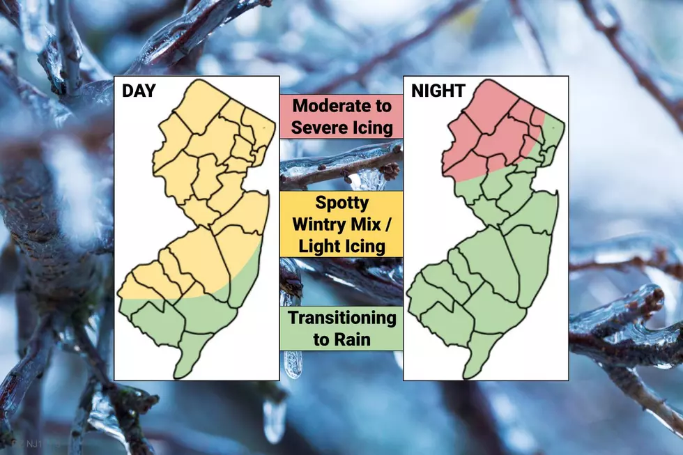
Monday Daytime
Spotty light wintry mix will be a nuisance throughout the state throughout the Monday daytime hours. That term — "wintry mix" — is the ultimate meteorological catch-all, encompassing a combination of snow, sleet, freezing rain, and plain ol' liquid rain. Sometimes, it feels like I'm being a "lazy" forecaster by using such a generic description. But it's important to acknowledge that a difference of just a degree or two on the thermometer can make all the difference in what falls from the sky.
Again, it will be spotty (widely spread out) and light in intensity during the daytime hours. But it doesn't take much sleet and/or freezing rain to make untreated surfaces very slippery. Be alert and aware of changing conditions, both overhead and underfoot.
A Winter Weather Advisory is in effect for most of the state Monday.
Temperatures will generally hover in the upper 20s to mid 30s from sunrise to sunset.
Monday Night: Northwest Jersey
Here's where the weather becomes truly treacherous. But only for one corner of the state — the "red" zone on the forecast map above.
The brunt of the storm — an extended period of moderate to heavy sleet and freezing rain — is expected to kick-in around 10 p.m. Even though the storm system has nudged slightly northwest, models are still showing a solid 1/4-inch+ of ice accumulation overnight. That's more than enough to snarl traffic and cause widespread power problems.
By around 4 a.m., I expect temperatures to rise sufficiently above 32 degrees that any icy mix will change to plain rain. There absolutely could be residual icing problems through Tuesday morning's rush hour.
An Ice Storm Warning covers Sussex, Warren, Morris, western Passaic, Hunterdon, and Somerset counties from 6 p.m. Monday to 10 a.m. Tuesday. That geography is very close to my expectations. The time window is a little wide, but I suspect it encompasses the daytime wintry mix and residual icing concerns too.
Monday Night: The Rest of the State
The forecast through 10 p.m. Monday evening is about the same as the daytime hours. Spotty light wintry mix could cause minor icing. Then, temperatures will rise sharply overnight. (Soaring into the 40s in South Jersey.) That means the peak of the storm will bring rain, the whole rain, and nothing but the rain for most of the state.
That rainfall could be heavy overnight, totaling about 3/4-inch by morning. Rumbles of thunder and marginally gusty winds (50-ish mph) are even possible.
Tuesday
I expect rain to exit the Garden State around mid-morning Tuesday — let's say 9 a.m. Breaks of sun should emerge by the afternoon.
So, I have to admit… Once the rain moves out, Tuesday looks like a nice day. We'll keep mild temperatures during the daytime hours, topping out in the lower 40s (north) to near 50 (central) to mid 50s (south). Some models have even suggested 60 degrees to the far south!
Unfortunately, the warmth won't last. Arctic air returns Tuesday night, and temperatures will tumble into the 20s by Wednesday morning.
Wednesday
Back to the freezer. Mostly sunny and cold, with highs only 30 to 35 degrees.
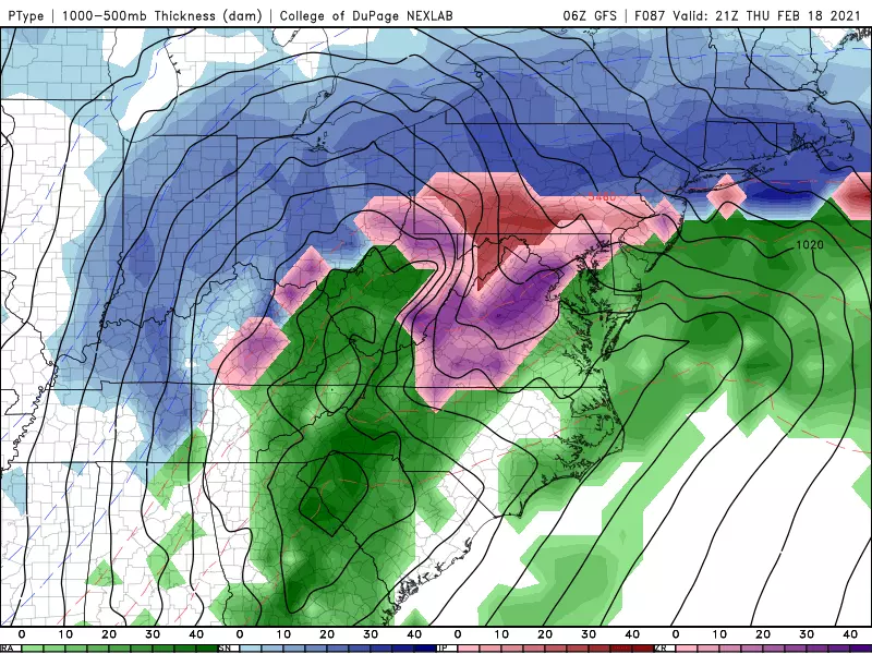
Thursday
Here comes our next winter storm. But there is good news — this will the grand finale of our month-long stretch of hyperactive weather. And it looks like a downright mess, with significant winter weather likely during the day Thursday.
I don't want to delve into too many details until our Monday-Tuesday ice storm is a goner. But just to give you a few general bullet points to ponder:
—Timing… Thursday morning to Friday morning
—Precipitation Types… Snow to Icy Mix to Rain
—Snow Accumulation… Up to 6-ish inches (moderate to major impacts)
—Ice Accumulation… Up to a 1/4 inch (moderate to major impacts)
In my opinion, the worst part about this storm will be the timing — conditions may go downhill severely between the Thursday morning and Thursday evening commutes. Again, we'll be on this one with more details and full coverage within the next day or so.
Friday and Beyond
Finally a break of quieter weather. Although that doesn't mean winter's over.
The weekend looks sunny, but cold. High temperatures for Saturday and Sunday will barely make it above freezing.
And then long-range models show a series of clipper systems sliding through New Jersey next week. Monday, Wednesday, Friday, Sunday. These will be your run-of-the-mill winter weather events — a few inches of snow possible, maybe just rain, with limited (but still potentially significant) impacts. We can manage those, after the hellish onslaught of nor'easters and ice storms of the past month.
Ice is tricky and treacherous — please take it seriously and be extra careful and safe out there.
Dan Zarrow is Chief Meteorologist for Townsquare Media New Jersey. Follow him on Facebook or Twitter for the latest forecast and realtime weather updates.
WEATHER: Why NJ’s potential ice storm is very concerning
More From 105.7 The Hawk
