Hot and humid with hazy sunshine Thursday, a great beach day
The Bottom Line
It's definitely summer. Temperatures in the 90s. Dew points in the 70s. Sticky, steamy, sultry.
The chance of rain over the next two days is actually minimal - only teeny tiny popup showers are expected for both Thursday and Friday.
As we move through the upcoming weekend, our weather will turn unsettled. Several waves of rain will combine with clouds. Your outdoor plans may be affected by bouts of wet, stormy weather. But at least we'll get a brief cooldown too.

Thursday
As we approach the midpoint of July, we're still in the hottest part of the year. So it should not be surprising in the slightest that we're talking about hot, humid, summer-ish weather.
There's actually one subtle improvement to talk about. In the last 24 hours, dew points have come down a little bit - on the order of 3 or 4 degrees. That's barely noticeable. But the air is slightly less stifling as we begin Thursday. Especially North Jersey, where there are numerous 60s on the temperature map.
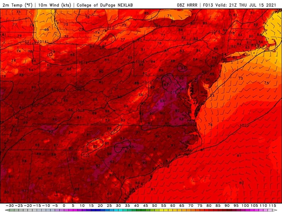
Lots of hazy sunshine will push high temperatures on Thursday into the upper 80s to around 90 degrees across most of the state. The humidity will push the heat index into the mid 90s. (The National Weather Service has put the five counties in northeastern NJ under a Heat Advisory, but I'm not sure I'd quantify Thursday's heat as especially "dangerous".)
As the headline of this post suggests, I believe Thursday has the makings of a fantastic beach day. The Jersey Shore will easily be the coolest spot in the entire state, as the sea breeze machine fires up. That will keep the fiery heat inland, and limit coastal high temperatures to around 80 degrees. The rip current risk is low, with only 1 to 2 foot ocean waves.
The recipe for thunderstorms requires three ingredients. Energy, in the form of heat. Moisture, in the form of humidity. And a spark, some source of atmosphere lift, which usually comes from a front, outflow boundary, or topography. It's that last element that's missing on Thursday. But if we see a little spark - particularly from the sea breeze front - I think we could get one or two teeny tiny popup showers. Very isolated - 99+ percent of the state will stay dry and storm-free.
Thursday night will stay warm and muggy. Under mostly clear skies, lows will only dip into the lower 70s by Friday morning.
Friday
Even hotter. Now we can start talking about potentially dangerous heat in urban areas.
High temperatures 90 to 95 degrees for most of the state (away from the coast). Heat index will approach 100.
Skies will be partly sunny. And just like Thursday, the only rain chance will be very isolated popup showers and thunderstorms late-day Friday.
Friday night looks especially steamy. Thermometers may not dip below the mid 70s. Blech.
Saturday
A steamy start to the weekend. Having said that, Saturday will be the best bet for weekend outdoor activities if you're hoping to stay completely dry.
High temperatures will once again surge into the lower 90s. I'm hopeful we'll get a more prominent southerly breeze (15+ mph), keeping the hot air moving around. Growing cloud cover will usurp the sun by the afternoon.
A slow-moving front will be the driver of several waves of rain starting Saturday late afternoon. It looks like a batch of thunderstorms with some heavy rain will come into view around 4 p.m. Saturday, passing across the state through late Saturday night. Showers may linger into early Sunday morning.
Sunday
A very different weather day. Unsettled, cloudy, cooler, and wet in spurts.
It looks like we'll have some scattered shower and "light" thunderstorm activity around the state throughout the day Sunday. It's not going to be a washout - but I can't guarantee any particular hour will be completely dry.
Meanwhile, skies will be mostly cloudy to overcast. That alone will keep high temperatures around 80 to 85 degrees, at the warmest.
The best chance for another round of steady (if not heavy) rain will be Sunday night, likely starting after sunset.
The Extended Forecast
There are still two possibilities for Monday. The GFS favors lingering wet, cloudy weather through about mid-afternoon. Meanwhile, the Euro pushes the aforementioned front all the way through, allowing for a much drier and brighter day.
In either case, high temperatures on Monday will probably end up below seasonal normals. More importantly, dew points will scale back a bit early next week, into the 60s. Not exactly dry, but much more comfortable than our recent stretch of tropical 70s.
The chance of rain for Tuesday and Wednesday won't be zero, but I currently favor a generally pleasant, warming forecast. We'll be back close to 90 again for the second half of next week.
The tropics are currently quiet. That means there are no surprises in the forecast. We'll probably stay in a hot, humid, and occasionally stormy pattern through the rest of July.
Dan Zarrow is Chief Meteorologist for Townsquare Media New Jersey. Follow him on Facebook or Twitter for the latest forecast and realtime weather updates.
Trending News Now
Gallery Credit: Trending News Now
More From 105.7 The Hawk

