Friday NJ weather: Elsa exits, then sun, then more thunderstorms
The Bottom Line
It has been a crazy morning so far across southern and coastal New Jersey. Top numbers so far: over 2.5 inches of rain (Mullica Twp, Atlantic Co), wind gusts up to 79 mph (Sea Isle City, Cape May Co), and up to 3 possible tornadoes (Somers Point, Tuckerton, and Mantoloking areas). Wow.
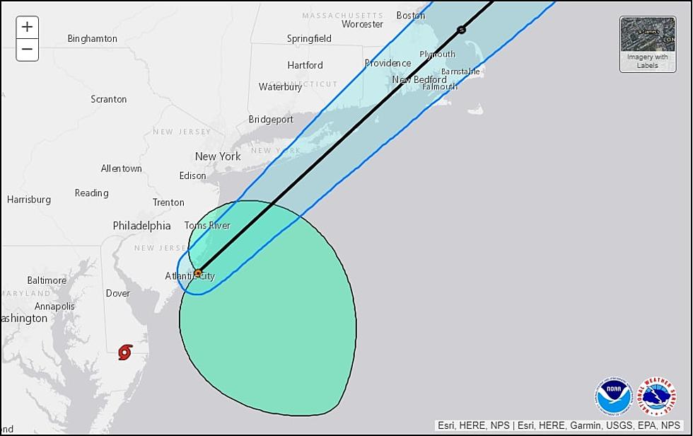
I believe Elsa briefly made landfall in Cape May County around 3 a.m. Friday morning. As of 5 a.m., the National Hurricane Center put the center of circulation just three miles east of Brigantine, Atlantic County.


Hopefully you're able to stay hunkered down and safe until the worst is done. Tropical Storm Warnings have started to be cancelled, as Elsa's center passes by. A Flash Flood Watch remains in effect statewide.
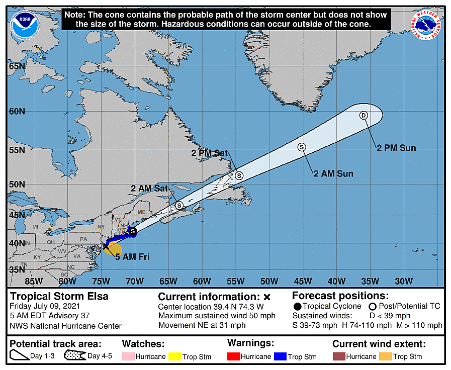
Here's the best news I could possibly give: Elsa is flying to the northeast. Weather will continue to range from inclement to nasty through mid-morning Friday. And then conditions will improve quickly through this afternoon. However, an additional round of thunderstorms is expected later on.
The weekend features mixed news: Saturday looks good, while Sunday turns unsettled again. Another steamy summery warmup is ahead for next week.
Friday: Elsa's Departure
As the heaviest band of rain and wind continues spreading north and west, the concerns of flash flooding and wind-driven power outages will continue spreading too.
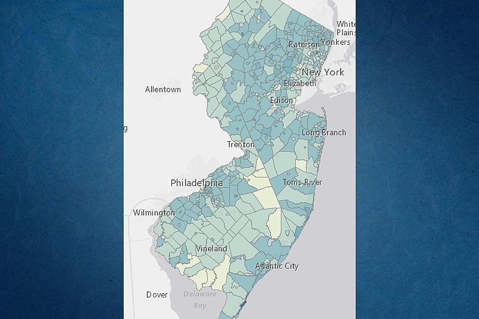
So far, rainfall expectations have been very close to forecast (1 to 3 inches for all but NW NJ). There are some mesoscale models that show some pockets of really heavy rainfall - on the order of 4 or 5 inches. We'll have to see how that plays out as the tropical rain band reaches central and northern NJ - the ground is pretty saturated there, which could lead to fast flooding issues.
The wind speed and tornado potential has been slightly higher than I anticipated. It looks like the greatest such threat has passed at this point. Nevertheless, gusts to 40+ mph will remain possible, and another quick spin-up or two can't be ruled out.
Remember, Elsa's coastal impacts are minimal along the Jersey Shore. However, a high risk of rip currents and rough surf is posted for today. And we could still see tidal waterways rise up to a foot. (Some of those back bays have weird orientations, which can lead to unpredictable tide patterns.)
As of this writing (5:30 a.m.), we're already seeing drier skies in SW NJ. I think 10 a.m. will be the big turning point - that's when the rain and wind will largely be gone from the Garden State.
Friday: The Rest of the Day
By Friday afternoon, I suspect we'll see substantial breaks of sunshine across New Jersey. It's still going to be a very warm and humid day, with high temperatures in the seasonable mid 80s.
In addition, an approaching cold front is forecast to fire off another round of scattered strong thunderstorms starting Friday late afternoon. (Totally unrelated to Elsa, by the way.) Once again, we'll be keeping eyes and ears on the sky for heavy rain, gusty winds, hail, and lightning.
This is the 4th day in a row with severe weather in the forecast. It could be the 4th day in a row with a Severe Thunderstorm Watch - that is pretty unusual.
The storm threat will wrap up by Midnight at the latest, and then skies will clear overnight. It will be warm and sticky, with lows dipping to around 70 degrees.
Saturday
The nicest day in this forecast! Thanks to Friday evening's cold front, humidity levels should dial back a little bit. (Dew points drop to 60-ish, rather than lower 70s.)
With a mix of sun and clouds, high temperatures should hit lower 80s across most of the state Saturday afternoon. The only potential issue? An isolated shower may clip North Jersey at some point.
Sunday
The morning should be comfortable, with temps in the 60s. But mostly cloudy skies and an ever-present chance of spotty showers from midday on with add a more unsettled feeling to the second half of the weekend. Temperatures will be warm, although below seasonal normals, near the 80-degree mark.
The Extended Forecast
Warming up and storming up again. Lower to mid 80s on Monday. Mid to upper 80s on Tuesday. 90s return by Wednesday and Thursday. Each day could feature a few popup showers and thunderstorms.
Dan Zarrow is Chief Meteorologist for Townsquare Media New Jersey. Follow him on Facebook or Twitter for the latest forecast and realtime weather updates.
Can You Name These NJ Beaches?
More From 105.7 The Hawk