Big weather transition for NJ to start 2022: Wet to windy to cold
UPDATE... This article is outdated...
For the latest winter storm forecast information, please refer to my newest weather blog post.
Phase 1: Rain, Rain, Rain
Happy New Year! 2022 is starting off with soggy and inclement weather for New Jersey. (For the record, 2021 started off almost exactly the same way: Rainy and mild.)
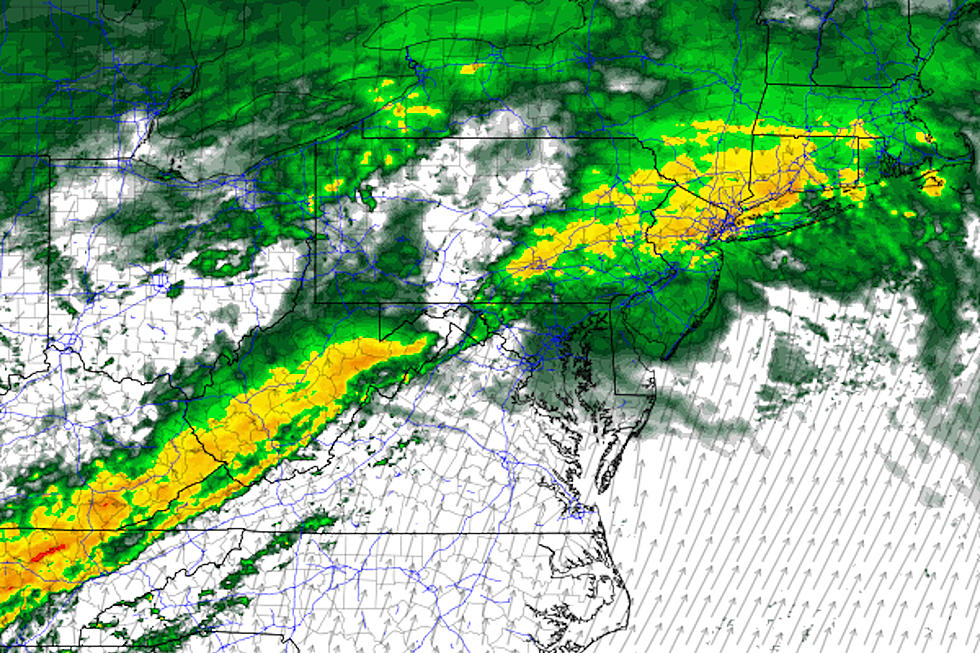
As of this writing (7:30 a.m.), scattered, light raindrops have begun falling over New Jersey. That's pretty much the story for Saturday's daytime hours: Bands of steady-ish rain passing right over New Jersey. No big concerns for flash/river flooding. Nor any wintry weather. You might hear a rumble or two of thunder along the way. (Especially as high temperatures surge to about 60 degrees.)
There will be some breaks in the rainfall action Saturday, but they won't last long. And skies will stay murky and grey and cloudy and misty/foggy for the duration.
The heaviest rain of the weekend is expected to come Saturday evening, as it pours for several hours.

Scattered rain will continue through Sunday morning. I don't think it will be as heavy and steady as Saturday daytime or nighttime.
Eventually, a cold front — the leading edge of cooler and drier air — will sweep from northwest to southeast across the state on Sunday. That will put an effective end to the rain sometime in the afternoon. Of course, it will also put an end to our stretch of warmer-than-normal temperatures. (More on the cooldown in a moment.)
Rainfall totals are forecast to range from 0.5 to 1.5 inches statewide. Healthy rainfall, and much needed for the "abnormally dry" southern third of New Jersey. Models have flip-flopped a bit over the past few runs about who gets the most rain. For now, North Jersey is favored to see the biggest downpours.
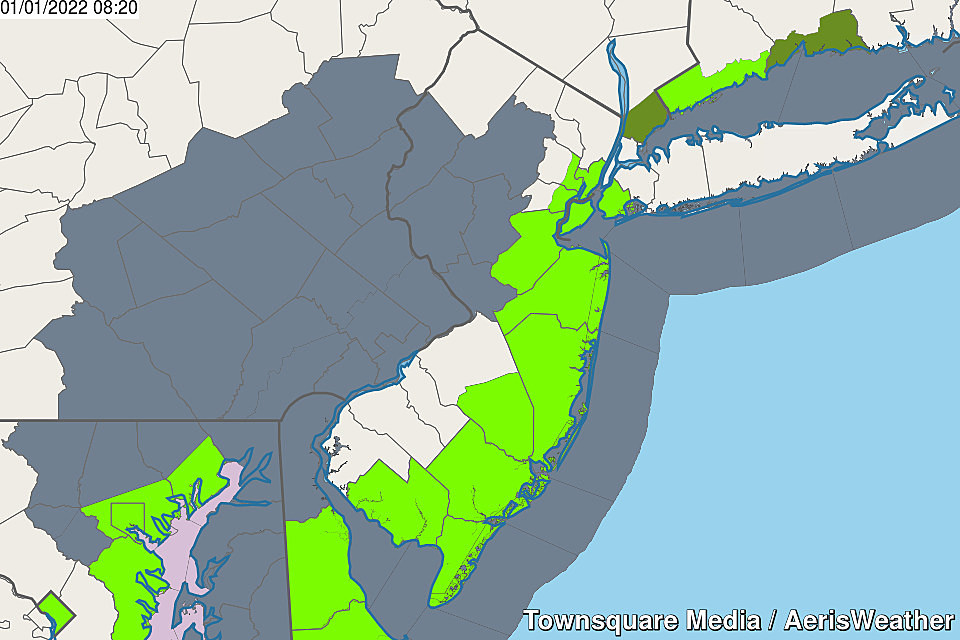
One more note: We are in a period of unusually high tides right now. It's not really weather-related, but daily minor coastal flooding is possible through the weekend. Coastal Flood Advisories are posted for the entire Jersey Shore, including the Raritan Bay and Delaware Bay.
Phase 2: The Wind Kicks Up
Along with the wet comes the wind. Both pre-front and post-front.
Throughout the weekend, amidst the rainfall, it will range from "breezy" to "windy" as a south-southeast flow keeps our atmosphere fully stocked with moisture and mild temperatures.
The biggest "burst" of wind is expected to come as our new arctic air mass arrives late Sunday. Although the latest estimates are tamer than we've discussed in previous days, gusts will probably top 30 mph through Sunday night and Monday. Enough to knock around unsecured holiday decorations, garbage cans, etc.
Of course, that wind is going to bite too, thanks to our fresh cold air mass. (More on that in another moment.)
Phase 3: One More Round of Precipitation
As the aforementioned frontal boundary drifts off-shore into Monday, one more piece of energy is expected to slide along it. If it's close enough and if the atmosphere is not too dry, we could see a period of snow through Monday morning. (Note: Those are big if's.)
The GFS model has been particularly bull-ish about the potential for up to two of accumulating snow. I am far less optimistic. Although it will be cold enough for an "all-snow" situation, I just think we'll be too far away from the "core" of the storm system for much havoc to be wreaked here in the Garden State.

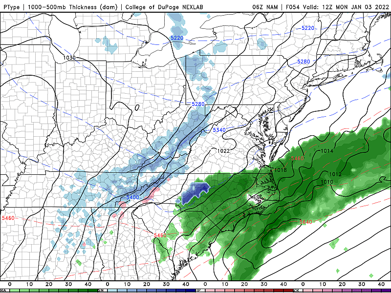
Having said that, even a brief period of moderate to heavy snow and a healthy coating on the ground could be problematic. Especially if it's particularly ill-timed, during Monday morning's big back-to-work and back-to-school commute. Best chance would be along the southern coast.
So I can't exactly call it "zero impact" — we'll continue to watch it, and you should too.
Phase 4: The Big Freeze
With all the nasty weather out of the way, let's talk about a real January chill coming our way.
Low temperatures Monday morning will probably average mid 20s across the state. And highs will struggle to reach the mid 30s, barely above freezing.
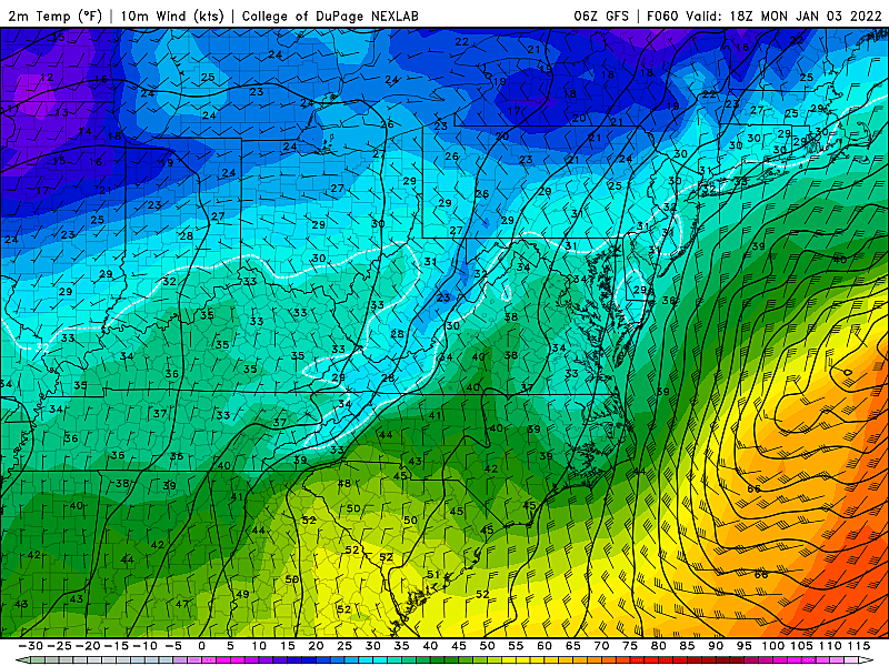
Add the continuing brisk wind, and it's going to feel quite blustery. Wind chills will probably be stuck in the 20s all day, at best.
As the wind dies down, Tuesday will probably be the coldest of the bunch, with thermometers sinking to around 20 degrees. Highs on Tuesday will hopefully reach the upper 30s, but that's still below normal for early January.
Our Next Weathermaker?
The really cold air will only last for Monday and Tuesday, before temperatures moderate to near-normal lower 40s on Wednesday.
Model guidance does show another storm system signal coming at the end of next week, in the Thursday-Friday time frame. But it's not a "slam dunk" — this is going to be one of those cases where the exact storm track will dictate temperatures, and therefore precipitation type. Sure, we could see some accumulating snow (really, our first of the season). But at this point, I'd say rain is just as likely.
It's still 5 to 6 days away at this point — just worth watching. If there is something sinister looming late-week, we'll start talking details around Monday or Tuesday.
Dan Zarrow is Chief Meteorologist for Townsquare Media New Jersey. Follow him on Facebook or Twitter for the latest forecast and realtime weather updates.
Counting down New Jersey's top 15 weather stories of 2021
Gallery Credit: Dan Zarrow
New Jersey's new congressional districts for the 2020s
Gallery Credit: Michael Symons
More From 105.7 The Hawk


