6 lessons learned from Thursday’s NJ tornado outbreak
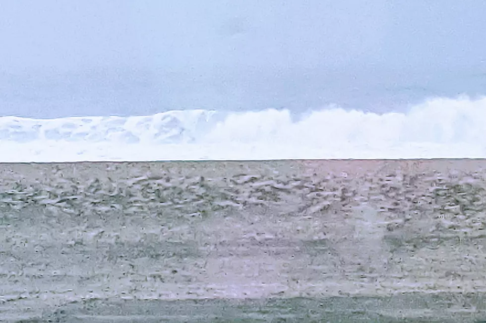
As the sun rose over the great Garden State Friday morning, residents of Mercer, Burlington, Monmouth, Ocean, and Essex counties woke to survey the damage of Thursday night's violent thunderstorms. It was New Jersey's most active severe weather day in over three decades.
We knew it was going to be a long day, with a potentially explosive atmosphere and an enhanced risk of severe weather. Unfortunately, the worst-case scenario played out.
After tracking non-stop tornadoes, mesocyclones, hail cores, and flash flooding for hours and hours Thursday evening, I wanted to reflect upon what New Jersey residents should take away from this historic weather event.
Yes, New Jersey does get tornadoes
New Jersey sees an average of two tornadoes a year. Tornadoes in New Jersey most occur as a result of local convective storms (like Thursday's) or tropical storms.
Of course, that number pales in comparison to Texas, with an annual average of 155.
According to the NJ State Climate Office, there's a lot of variation to our paltry annual statistic. Between 1951 and 2020, the top year was 1989 with a total of 17 tornadoes confirmed here. On the flip side, exactly 20 of those 70 years on record had exactly zero NJ twisters.
The crazy thing is we've already had three confirmed tornadoes in NJ this month - two from Elsa on 7/9 and one from a severe storm on 7/17.
Is there a particular reason the last three years have been particularly tornadic here? Not necessarily. Yes, there is overwhelming evidence that the earth's climate is changing, trending toward both warmer temperatures and more frequent extreme weather. However, individual weather events like Thursday's are too small in both geographical and time scale to specifically "blame" on climate change. Even three active years in a row don't mean much - we could just as easily see the next three years deliver few or no tornadoes.
Just a reminder that we do indeed need to watch for dangerous twisting storms, just like in Tornado Alley.
You need a severe weather safety plan
When a Tornado Warning is issued for your area, you need to take shelter immediately. Period. Full stop. Do not pass GO. Do not collect $200.
So you need a plan, before the wind starts to blow.
The classic storm shelter in New Jersey is a basement. Great choice.
But what if your house doesn't have a basement? Or if you live in an apartment or a condo? Or, worse yet, you're out driving when a warning comes across?
I started my broadcast meteorology career at KSWO-TV in Lawton, Oklahoma. And we had a mnemonic that we used during every severe weather event. Local school children were even taught our system.
It's called the "DUCK" rule. No, not quack quack. D stands for Downstairs. U is Underneath something (like a mattress or piece of furniture). C is for the Center part of your house. And K reminds you to Keep away from windows.
If you can follow all four pieces of the DUCK rule, fantastic. The bottom line: The more of those elements you can incorporate in your safe place, the safer you will be.
Take a moment right now to consider the best place to seek shelter in your home the next time a tornado is imminent. Maybe it's a bathroom or closet. Maybe it's hunkering down behind a kitchen counter or couch, to protect yourself from flying glass and debris if a window breaks. Make sure it's somewhere easy to access within about a minute or two. And make sure everyone in your family and household knows where to go and what to do.
Your cell phone will alert you to certain warnings
In New Jersey on Thursday, a total of 12 tornado warnings and 6 flash flood warnings were issued. And each one of those set off every single cell phone within the warning polygon.
That system is called Wireless Emergency Alerts, and has been transmitting certain weather warnings across the U.S. for the past nine years.
I've received several e-mails and social media comments asking why this system is necessary. Especially since polygon-based warnings admittedly include a large area and population that won't see dangerous weather.
Meteorologists are well aware of the limitations and shortcomings of the warning and notification infrastructure. It's something the National Weather Service is actively working on - smaller warning areas, more specific impact indicators, and better overall forecasting skill.
For now, I'll just say that the system is way better than it used to be (in the county-based warning era). And it's way better to be safe than sorry.
You need to take those warnings seriously
Tornado warnings are the king of all weather advisories. They are short-fused, usually lasting only 15 to 60 minutes. They are only issued when radar or a storm spotter reports a tornado is imminent. And even though tornadoes are a very localized, microscale phenomenon, the wind can be incredibly destructive.
This is precisely why I never "hype" my forecasts, whether calling for thunderstorms, hurricanes, or blizzards. Because I need you to take real weather threats seriously.
You will always hear me take a more serious tone in my forecasts on a tornado day. And you'll see a bright yellow or red alert icon on my web forecast. With good reason. I always try to highlight those days when the weather will impact your plans and will get dangerous. That's definitely the time to practice extra vigilance and common sense.
Storm anxiety is a real problem
Thunderstorms are scary. They're loud, sudden, and powerful.
Severe weather is even scarier. Mother Nature's fury is both beautiful and fearsome.
Know that it is totally natural to suffer from "storm anxiety" before, during, and/or after a big weather event. You've seen photos and you've read stories. Lives and property can literally be at stake during a storm. But as long as you stay "weather aware" and are prepared for the bad weather, play it safe, and hunker down in a sturdy building, odds are good that you'll be OK.
If you search around the internet, there are plenty of relaxation techniques to help yourself, your children, and your pets cope with thunder. Stay connected and communicate these concerns with friends and family. And if the emotional impact of severe weather becomes a serious problem, you might consider professional help.
The Mental Health Association in New Jersey runs a toll free Disaster Mental Health Helpline: (877) 294-HELP (4357).
I was scared
As I mentioned, I started my career in the middle of Tornado Alley. Severe thunderstorms, wind, hail, flooding, and tornadoes are a way of life there. Every spring and fall.
So I'm well-versed in covering and communicating severe weather threats. I'd even consider it my meteorological specialty.
But there were three moments on Thursday that really got to me and gave me pause:
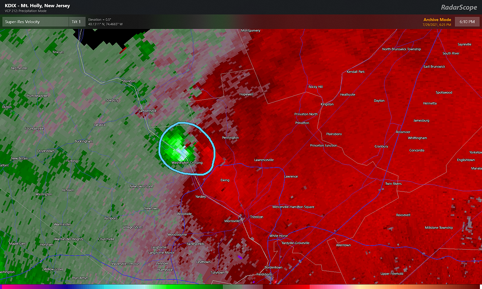
1.) When I saw the incredibly strong rotation signature just over the Delaware River in Bucks County, Pennsylvania. It was the immediate realization that a long-track tornado could scrape through Hunterdon and Mercer counties. In New Jersey. Right in the heart of my listening area. Heck, right over the radio station. The National Weather Service was totally justified in the "particularly dangerous" language in their warning products on that storm.
2.) When the last storm cell of the night hit the Barnegat Bay near Waretown and Barnegat, it just exploded. The couplet on radar and estimated wind speeds were undeniably tornadic. There was no doubt in my mind there was a waterspout headed right for the northern end of Long Beach Island. And unfortunately, it did do substantial damage as it came on-shore in the High Bar Harbor neighborhood of Long Beach Township.
3.) The end of the night. I had been on the radio for over 18 straight hours, talking non-stop about thunderstorms. I'm still reflecting on what will probably be deemed one of New Jersey's most serious severe weather outbreaks on record. I am eternally grateful to my colleagues for their support before, during, and after the storm. I give major props to the fine meteorologists at the National Weather Service in Mt. Holly, the National Weather Service in Upton NY, and the Storm Prediction Center for their excellent forecast guidance and information. And to my listeners, you'll never know how much I appreciate and respect the trust you put in my forecasts.
I hope you and your loved ones are well, after such a dramatic day of weather. If you have any feedback on our severe weather coverage or any stories to tell, please don't hesitate to reach out.
Dan Zarrow is Chief Meteorologist for Townsquare Media New Jersey. Follow him on Facebook or Twitter for the latest forecast and realtime weather updates.
BEEP BEEP BEEP: These are the 13 types of Wireless Emergency Alerts auto-pushed to your phone
Gallery Credit: Dan Zarrow
Parkway stops getting renamed after these NJ greats
Gallery Credit: Dino Flammia
More From 105.7 The Hawk