
Weather in a word for NJ Monday: Wet
A Flash Flood Watch has been issued for most of New Jersey, as bands of moderate to heavy rain are expected dump over an inch of rain across the state.
After such a beautiful almost-fall-like weekend, it depresses me incredibly to bring you such a wet, sloppy forecast to start the workweek. The bad news: most of the day will be a washout, with flooding and strong storms possible. The good news: After a potential washout Monday, the rest of the week looks pleasant and dry.
Timeline
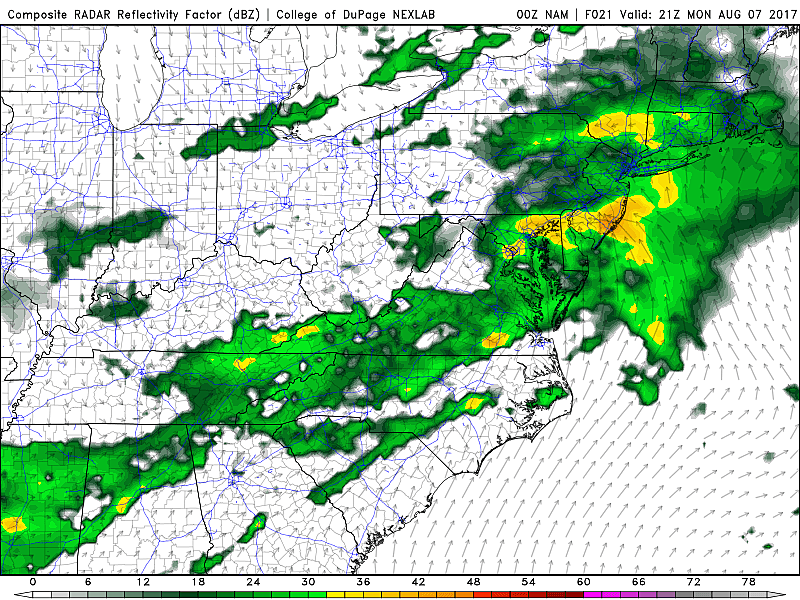
As of this writing (6 a.m.), rain is just starting to cross the Delaware River into New Jersey. Rainfall during the morning hours is expected to remain fairly light and scattered.
By Monday late morning through early evening (10 a.m. to 6 p.m.), bands of heavy rain will begin to make the day soggy and travel difficult. Embedded thunderstorms are possible in this time frame.
Lingering showers and thunderstorms will continue through late Monday night, tapering off substantially by around Midnight. Fog, drizzle, and residual showers are possible through Tuesday morning.
Weather Impacts
Forecast models suggest that 1 to 2 inches will fall across most of New Jersey, with the highest totals to the south. Localized totals over 2 inches will be possible where truly torrential rain falls or training thunderstorms occur. This is more than sufficient to cause flooding of low-lying and poor-drainage areas. The Monday evening commute could be particularly impacted.
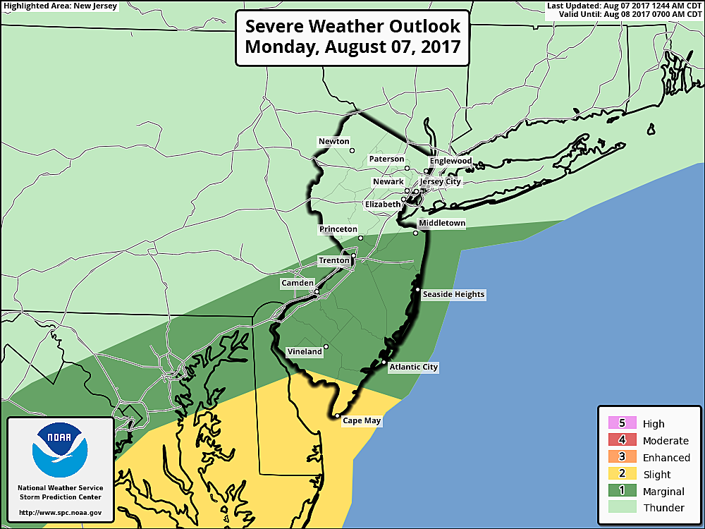
In addition, a marginal amount of shear and instability could produce some gusty thunderstorms. Best chance would be in South Jersey from late afternoon through the evening hours.
Needless to say, it's not going to be a beach day along the Jersey Shore. The ocean will be a bit rough on Monday with waves up to 4 feet. A Moderate Risk of dangerous rip currents has been posted for the entire Jersey Shore. No coastal flooding or significant beach erosion is expected from this storm.
Flash Flood Watch
Due to the extended period of heavy rain, the National Weather Service has issued a Flash Flood Watch for most of New Jersey. This advisory serves as a heads-up to potentially dangerous flooding of roadways, rivers, streams, and creeks. Keep in mind: the ground is still pretty saturated from previous rounds of rain.
The Flash Flood Watch is in effect for the following counties for the following times:
--From Noon to Midnight for Atlantic, Burlington, Camden, Cape May, Cumberland, Gloucester, Mercer, Middlesex, Monmouth, Ocean, and Salem counties.
--From Noon Monday to 6 a.m. Tuesday for Eastern Bergen, Essex, Hudson, Eastern Passaic, and Union counties.
Beyond the Rain
The combination of wet weather and thick clouds will prevent thermometers from climbing more than a few degrees on Monday. High temperatures will be limited to about 70 degrees, give or take.
Given the abundant ground-level moisture (read: puddles) Monday night, fog is a pretty good bet for Tuesday morning. There might be a residual shower early Tuesday too.
By Tuesday afternoon, skies will clear and our weather will dramatically improve. With increasing sunshine comes increasing temperatures, recovering to around 80 degrees.
Wednesday and Thursday look good too, with mostly to partly sunny skies, light winds, and pleasantly warm high temps in the lower to mid 80s.
More From 105.7 The Hawk


