Showers and thunderstorms return to NJ Tuesday
For the first time in 6 to 11 days (depending on where you live), Mother Nature finally delivered a fully dry day on Monday! Delightful high temperatures in the 70s, spectacular sunshine — what more would you want from a late May day? (Aside from lower pollen levels, that is.)
Our weather forecast slips downhill again with showers and thunderstorms expected throughout Tuesday. However, this time around, the burst of clouds, rain, and cooler temperatures will be temporary.
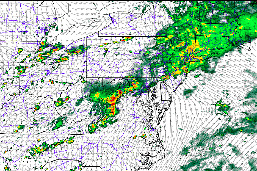
As of this writing, the first batch of rain is just an hour or two away from crossing the Delaware River in western NJ. This will be the first of several rounds of rain to impact the Garden State over the next 18 to 30 hours. Here's what I'm thinking:
--Not a washout — while it's not going to rain constantly all day, the forecast reads as "a wet day" overall.
--The steadiest, heaviest rain will arrive from Tuesday afternoon through evening.
--Thunder and lightning are likely, with a few downpours along the way too.
--The severe weather risk (wind, hail, tornado) is very low.
--Rainfall totals should end up less than a half-inch for most of the state, with locally higher amounts.
Bands of steady rain will taper to isolated showers by Tuesday evening, say after 10 p.m. There will almost certainly be pockets of dense fog overnight, and it's going to feel pretty muggy. Low temperatures will only fall into the lower 60s by Wednesday morning.
Wednesday's forecast is a bit tricky, especially around South Jersey. There's a chance for lingering showers and clouds — which would lead to at least the first half of the day staying dreary and damp. Eventually, skies will break into sunshine once again. That's most likely to happen Wednesday morning in North Jersey, and certainly by Wednesday late afternoon at the latest for South Jersey. High temperatures will spike to around 80 degrees thanks to the abundant sun.
And then we enter a pattern of drier, warming weather that will take us through the start of the upcoming Memorial Day Weekend.
Thursday looks great — sunny and warm, with high temperatures around 80 degrees. (As is the norm, the Jersey Shore will be at least 10 degrees cooler than further inland, thanks to the sea breeze.)
On Friday, a stronger southwest breeze will carry in even warmer air. We'll see highs in the lower to mid 80s away from the coast. The day will remain dry.
It's hard to believe the Memorial Day Weekend is just a few days away! Saturday is looking hot, with thermometers potentially popping above 90 degrees across much of the state. I'm sure the beach is going to be a very popular place on Saturday — as long as the sea breeze wins over the land breeze (I think it will), air temps will be limited to the 70s near the coast. Ocean temperatures currently range between 61 to 66 degrees along the Jersey Shore.
The rest of the weekend is looking shaky. A cold front looks to drive in clouds, scattered showers, and much cooler temperatures (lower 70s) on Sunday — the day might not be a total loss, but it certainly looks unsettled. Memorial Day Monday is modeled to be even cooler, with highs only in the 60s at best. As it stands now, Monday reads as a cloudy, breezy, rainy day.
More From 105.7 The Hawk


