Rain/snow may make for a slick Monday morning commute for NJ
Snow accumulation will be light and limited to the northern third of the Garden State.
'Tis the season for wintry weather, and it looks like New Jersey will be clipped by a bit of white stuff (and wet stuff) Sunday night through Monday morning. The incoming disturbance is admittedly weak, and snow/rain totals will be unimpressive. In the middle of the winter season (January-February), I probably wouldn't even bother blogging about such a minor weather event. However, because it's still early in the season and because of the overnight-early morning timing, it's important that all New Jerseyans know what to expect.
For snow to occur, we need a few basic meteorological ingredients. First is cold air: both at the surface and way up in the atmosphere. Second is moisture: cold air doesn't contain a lot of moisture by definition, but we need just enough throughout the atmosphere to sustain precipitation. And third is a forcing: a storm system that generates atmospheric lift to create that precipitation.
I think we can put a checkmark in those three basic boxes. High temperatures on Sunday will range from 45 to 50 degrees, and we will likely experience a freeze in North Jersey on Monday morning. And, while it's not a direct hit, the incoming storm system will push sufficient energy through New Jersey early Monday morning to produce light to moderate intensity snow and/or rain.
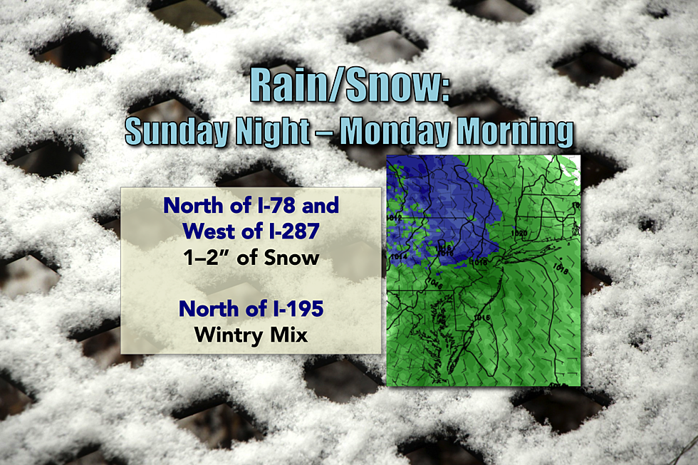
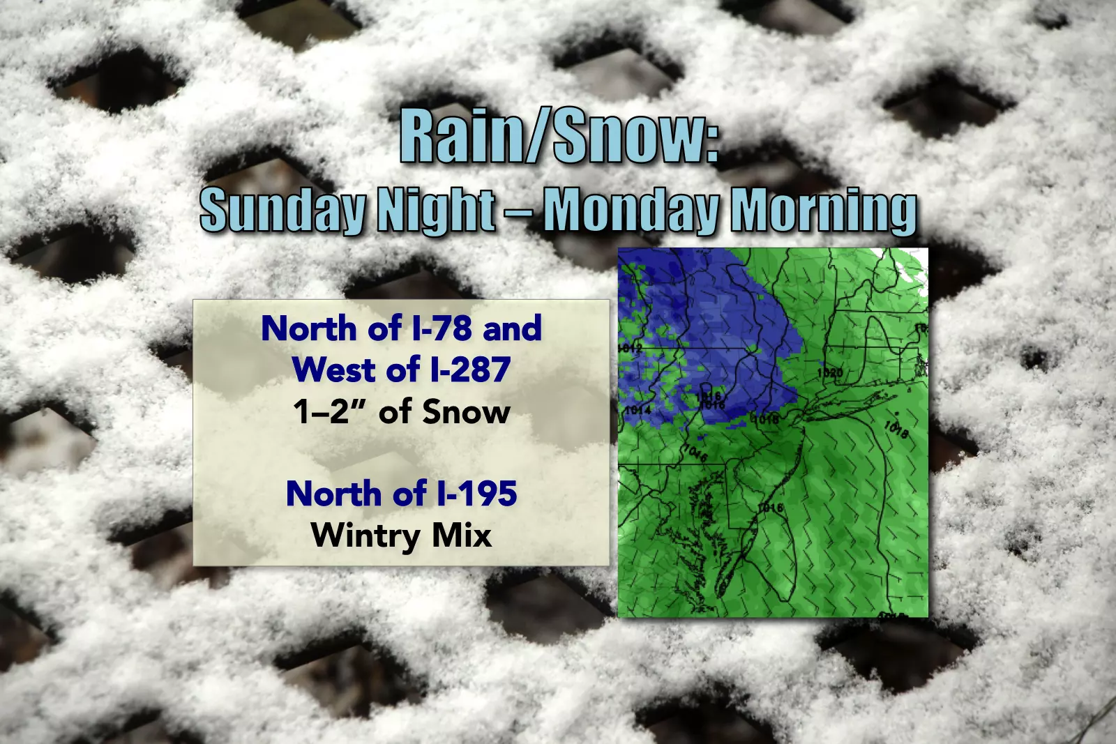
Where? As usual, the best chance for accumulating snow will be in the northern third of New Jersey. More specifically, I'm eyeing the area approximately north of I-78 and west of I-287 for possible snow accumulation. A wintry mix of snow, sleet, and rain will be possible as far south as I-195.
When? There is some model disagreement regarding the precise start time of our impending rain/snow, so I have to present a pretty big window for the first raindrops and snowflakes: sometime between 7 a.m. and 1 a.m. The heaviest rain/snow will occur in the Monday predawn hours, between about 1 a.m. and 7 a.m. Forecast models are in pretty good agreement about ending all remaining precipitation by about 10 a.m.
How Much? Always the big question! In the "mostly snow" area north of I-78 and west of I-287, about an inch of light, fluffy snow could accumulate. The latest NAM model suggests upwards of 2 inches on some of the hilltops - I wouldn't rule out that possibility. While there could be some accumulation on grassy or metal surfaces further east and/or south of this area, it should be minor.
Impacts? Again, the big problem here is that the storm system coincides with the Monday morning commute. There will almost certainly be some slick road surfaces in North Jersey. Additionally, if it's still cold enough for snow (rather than rain) during drive-time, reduced visibility may also be a concern. It might be worthwhile to set your alarm clock a little bit earlier for Monday morning, in case you encounter any travel inconveniences.
What's Next? There will be two more storm systems to watch this week for winter weather potential: one on Tuesday, and one on Thursday. The Tuesday storm could add a couple more inches of accumulation on top of Monday morning's snowfall in NW NJ. And early model runs suggest a statewide dusting (at least) will be possible alongside a renewed push of cold air on Thursday. We will, of course, cover these possibilities extensively on-air and online as they approach.
More From 105.7 The Hawk


