
Presidents Weekend warmup: Widespread 60s for New Jersey
Usually mid-February brings unbearably cold and snowy weather to the Garden State. Not this year.
I love this forecast, and I think you will too. Some delightfully warm days are ahead!
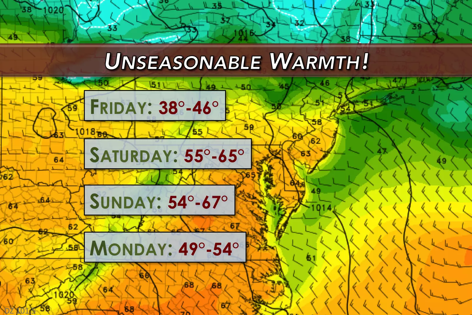
Friday morning is starting off cold, with an even spread of 20s from the top to the bottom of New Jersey. Thermometers will finish a few degrees warmer than Thursday, in the lower to mid 40s for Friday afternoon. Mostly sunny skies will counter the seasonably cool temperatures and the stiff breeze, which may gust to about 20 mph through the afternoon.
I'll call Friday night chilly — not quite cold — as lows dip to around the 30-degree mark by Saturday morning. Aside from a few clouds overhead, it will be a quiet night.
And then the warmup begins! As winds shift to a southwesterly direction, high temperatures on Saturday are expected to soar to the upper 50s to lower 60s. In case you're keeping score, that's about 20 degrees above normal for mid-February! (Although a few degrees shy of record highs.) Mostly to partly sunny skies. Light winds. Dry weather. Saturday looks simply gorgeous.
Sunday looks... OK. A weak shortwave will bump New Jersey sometime between Saturday night and early Sunday morning. That will increase cloud cover quite a bit. And it might produce a shower, with the best chance for rain would be in South Jersey. But I have to stress how light the rain would be, and how slight this rain chance is. It shouldn't really affect the overall beautiful weekend weather picture, especially given the early morning timing of these sparse raindrops.
By Sunday afternoon, skies should return to sunshine, keeping temperatures nice and warm for another day. I've pushed our forecast highs for Sunday upward, into the lower to mid 60s across the state. Could we make a run for 70? If we see sunshine by Noon, and cooler air holds off until later (keep reading), it's possible.
Yes, Monday will turn noticeably cooler. But with high temps in the lower 50s, we can still call it mild as we stay above seasonal normals. I'm leaning toward sunshine, although the NAM model maintains stubborn cloud cover Monday morning. In either case, our Presidents Day stays pleasant.
Our current forecast keeps Tuesday cool, and introduces some light rain on Wednesday. Thursday looks warm, with a return to 60s expected.
With a mild next-to-last week of February, winter is rapidly running out of time. Models suggest another push of cold air will arrive as February turns to March. But if that doesn't happen, our chances of a snowy March may be severely limited.
More From 105.7 The Hawk


