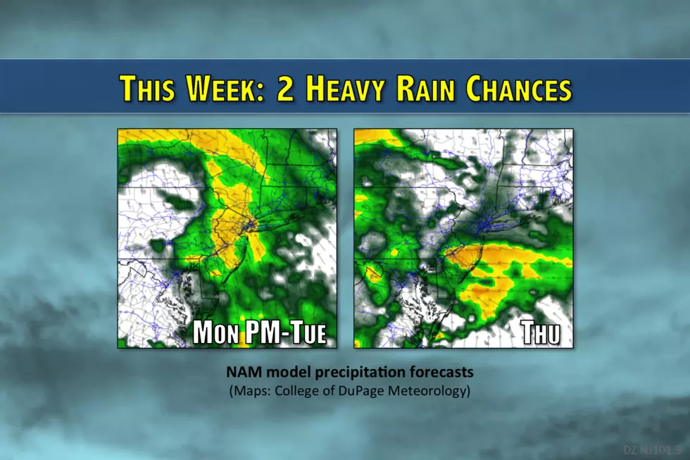
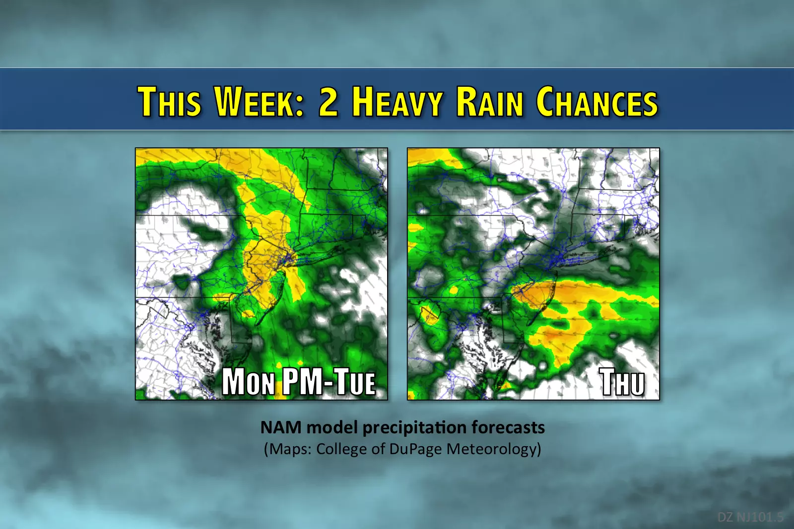
More heavy rain, more flooding in the forecast for NJ
Not one but two moisture-rich storm systems will potentially produce heavy rain and flooding over the Garden State through the first week of April.
Here are your weather headlines for Monday, April 3, 2017...
From Mild to Wet #1
The first weekend of April progressed from miserably heavy rain on Friday (OK, that was technically the last day of March) to beautiful sunshine and mild temps on Sunday. For the week ahead, temperatures should stay on the warm side of normal. We do, however, have a couple more rounds of April showers and outright downpours in the forecast.
Monday daytime should remain pleasant, as temperatures climb from the upper 30s in the morning, to the mid 60s by the afternoon. Skies will start mostly to partly sunny, with increasing clouds through the day. While there's a chance that a few showers will creep into New Jersey by late afternoon and early evening, the majority of our impending rainfall will hold off until later Monday night.
This storm system has a clear connection to the super-moist Gulf of Mexico. So, pockets of moderate to heavy rain are expected across New Jersey starting late Monday night through early Tuesday morning. (Yes, the heaviest rain will fall in the predawn hours Tuesday.) For the rest of Tuesday, the rain appears less steady, but we do have to keep showers and thunderstorms in the forecast all day. I don't think Tuesday is going to be a "total washout," but it will probably be a wet and stormy day overall.
Let's talk about specific impacts for this storm system...
Flooding? Likely. We will probably see a wide swath of 1 to 2 inches of rain across the Garden State. Meanwhile, the ground is already saturated and waterways (rivers, streams, and creeks) are still running high from Friday's soaking rain. So, given these wet "antecedent conditions," the chance for flooding will be higher. This is especially true for the northern half of New Jersey (above Interstate 195), where the National Weather Service has issued a Flood Watch from late Monday night through Tuesday.
Severe weather? Possible. As temperatures climb to near 70 degrees on Tuesday afternoon, we could see a few stronger storms break out. Gusty winds would be the primary concern.
Winter weather? Nah. While I'm still not ruling out snowflakes sometime in April, temperatures will stay above freezing for the entire state for the duration of this storm system.
From Mild to Wet #2
By Wednesday, our storm system will be departing, and so our weather will be clearing. We'll find ourselves in a pleasant piece of the atmosphere, with a mix of sun and clouds and a stiff breeze. Forecast highs return to the mid 60s for most of the state.
And then along comes yet another storm system, scheduled for early Thursday morning through Thursday evening. Heavy rain, thunderstorms, and a brisk wind are all expected Thursday.
Drier Days Ahead?
Beyond Thursday, forecast models suggest we will enjoy a period of drier weather. While there could be a few stray showers on Friday, it will be drier. Temperatures, however, will be cooler, in the 50s during the day. The weather for the upcoming weekend looks quiet and seasonable, with mostly to partly sunny skies and highs in the mid 50s to lower 60s.
More From 105.7 The Hawk


